

Most people who’ve heard of it have never been. Most people who’ve been never forget it.
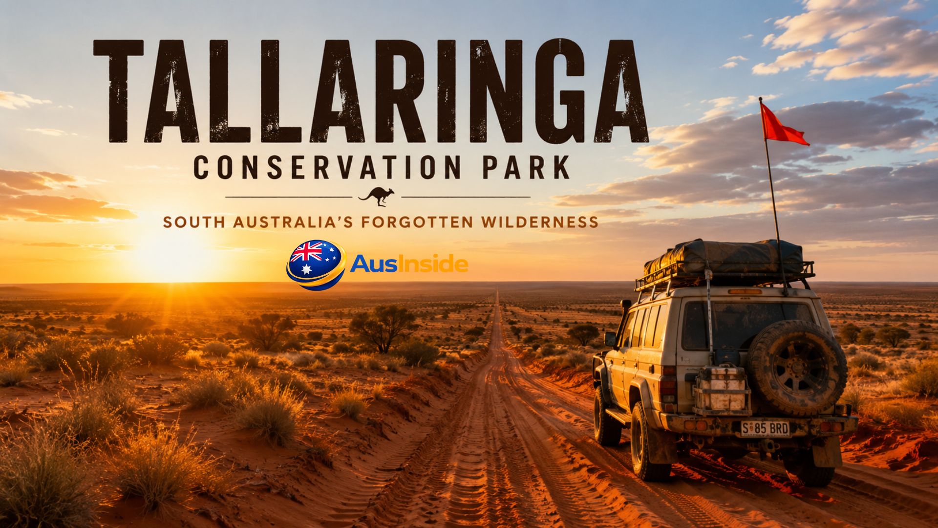
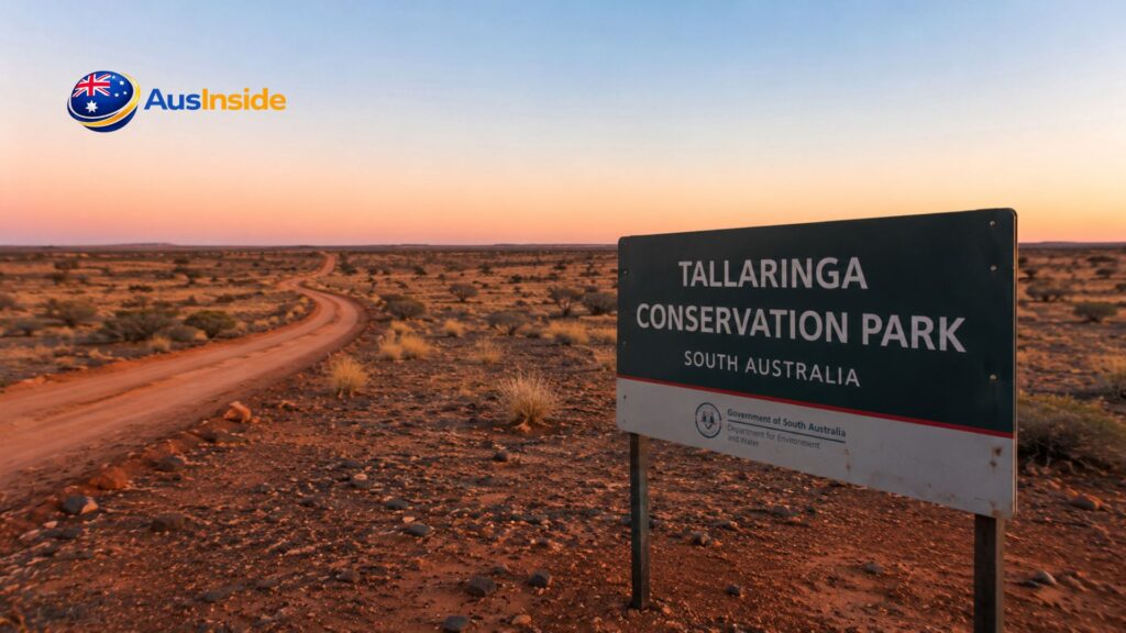
Tallaringa Conservation Park sits about 100 kilometres west of Coober Pedy, deep in the arid interior of South Australia, where the Great Victoria Desert begins in earnest and the modern world runs out of reasons to follow. It covers 12,688 square kilometres — roughly the size of Lebanon — and on most maps, it’s just a blank beige shape with a name. No icons, no symbols, no suggestion of what waits inside.
That blankness is the first thing competitors miss about this place. Tallaringa isn’t just remote. It’s the kind of remote where your phone stops being a device and becomes ballast. Where the horizon is so flat and uninterrupted that you start to feel the curvature of the Earth. Where nights are so dark that the Milky Way throws a shadow.
This park has layers that go thirty thousand years deep — Aboriginal trade routes, atomic-era surveying history, a well that was lost to European knowledge for half a century, rare birds that barely anyone has ever seen, seven species of the same tree coexisting in a landscape most ecologists once wrote off as barren. The 2018 management plan was its first. Ever. A park proclaimed in 1991 that didn’t have a formal strategy until 2018 — which tells you everything about how long it took for the outside world to take Tallaringa seriously.
If you want to understand this place, you need to go several layers deeper than most guides bother to go. That’s exactly what this article does.
Have A Look On It: Hinterland Regional Park
- What Tallaringa Actually Is — And Why the Label "Conservation Park" Undersells It
- The Landscape: Reading the Desert Like a Document
- 30,000 Years: The Cultural History Nobody Writes About Properly
- Tallaringa Well: A Water Source With Three Centuries of Recorded History
- The Anne Beadell Highway: The Road That Was Built for a War
- The Ecology That Surprised the Scientists: What the 2015 Survey Found
- The Threats: What's Actually Endangering Tallaringa
- Visiting Tallaringa: Everything You Actually Need to Know
- When to Go: The Real Answer Is More Complicated Than "Winter"
- The Night Sky: Something Nobody Mentions But Everyone Who Goes Remembers
- What You Don't See On Other Sites: The Deeper Observations
- Practical Summary: Everything in One Place
- Key Takeaways Before You Decide
- FAQs
What Tallaringa Actually Is — And Why the Label “Conservation Park” Undersells It
South Australia uses the term “Conservation Park” as a formal protected-area category under the National Parks and Wildlife Act 1972. It’s a tier below National Park status, and it theoretically allows for some sustainable resource use — mining rights can be acquired under the Mining Act 1971 and Petroleum and Geothermal Energy Act 2000 subject to ministerial approval. That’s a tension that sits quietly in the proclamation documents but rarely makes its way into tourist write-ups.
Tallaringa was officially proclaimed on 19 December 1991, but the groundwork started years earlier. From 1984 to 1990, systematic ecological assessment of the Tallaringa Block was conducted under the Biological Survey of South Australia — a state-wide program that had been running since 1971 to document fauna and flora across the landscape before it was converted to pastoral or mining use. The explicit question being asked was: pastoral land or conservation reserve? The biological surveys of 1988 and again in 1993 answered that question decisively. The ecological and cultural values were too significant to lose to grazing.
Photopoints were installed across the park’s plant communities as part of that early assessment — monitoring stations to measure long-term structural change in the vegetation. They’re still there, still being referenced, still helping park managers understand how fire and drought and rainfall interact with the mulga woodlands and spinifex plains over decades.
The park is classified internationally as IUCN Category VI — a “protected area with sustainable use of natural resources.” That designation acknowledges the complexity of managing a place this large, this remote, and this culturally significant while keeping it ecologically intact.
It’s managed jointly. Not just by the South Australian government, but through a formal co-management partnership between the Antakirinja Matuntjara Yankunytjatjara (AMY) people and the state — facilitated by the Tallaringa Conservation Park Advisory Committee. The District Council of Coober Pedy also has input. That three-way structure produced the park’s first management plan in 2018, developed through a process called Manta palya — a traditional AMY framework meaning “healthy Country.” The plan integrates cultural aspirations, ecological priorities, and economic opportunities for Indigenous communities in a way that standard government conservation documents rarely achieve.
Google Map Location
The Landscape: Reading the Desert Like a Document
Stand at the eastern boundary, just past where Mabel Creek Station ends and the Dog Fence crosses the Anne Beadell Highway, and the landscape immediately starts explaining itself.
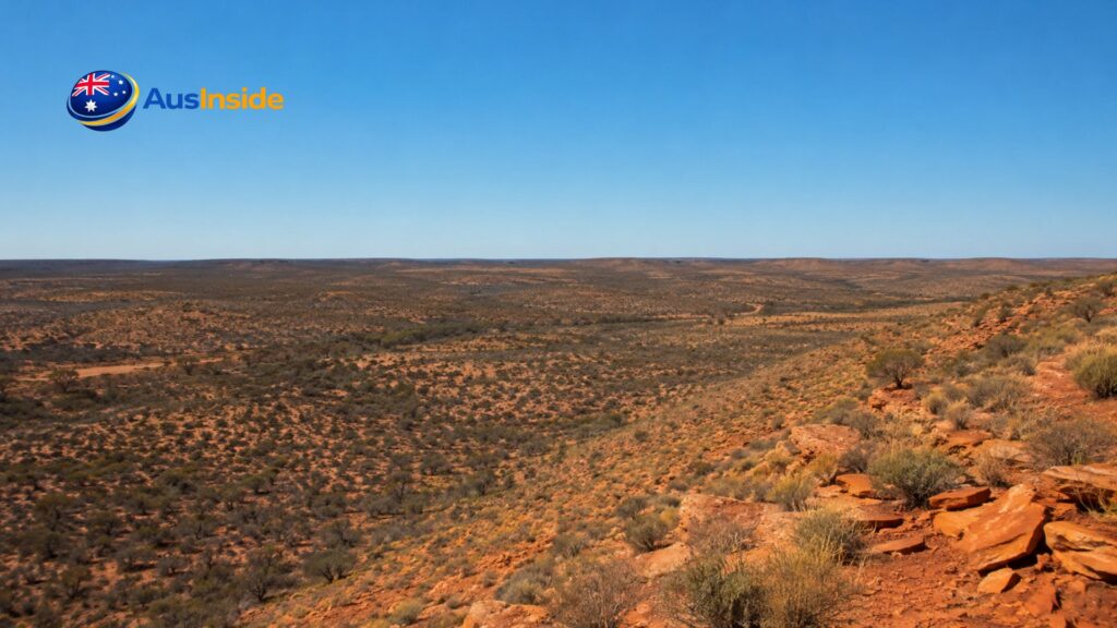
The park sits on the eastern fringe of the Great Victoria Desert bioregion. The dominant landform is a series of long, east-west oriented vegetated sand dunes — built by wind systems that have been active here since the last glacial maximum, when the interior of Australia was significantly drier and more windswept than it is today. These dunes aren’t bare. They’re covered in spinifex (Triodia species), which grows in distinctive circular clumps that expand outward as the plant ages, leaving dead hollow centres behind.
Between the dune ridges are swales — flatter interdune corridors where the soil is finer, clay content is higher, and after rain, conditions are briefly lush. This dune-swale alternation creates two entirely different habitat types within metres of each other, which is part of why Tallaringa’s biodiversity is higher than you’d expect from a single rainfall figure.
The gibber rises are a different thing entirely. Gibber is derived from an Aboriginal word for stone, and these plains are exactly that — surfaces armoured in polished ironstone pebbles, the residue left behind when millions of years of wind and water erosion stripped away the finer material. Walking on them feels like walking on a vast, rust-coloured mosaic. Nothing grows easily here except the hardiest spinifex and occasional low shrubs. But reptiles love them. The radiant heat from the stones in the morning is optimal basking terrain.
The park receives an average of approximately 150 millimetres of rainfall annually, though this number is almost meaninglessly variable. Some years bring double that, concentrated in a few intense events. Others produce almost nothing for 18 months. The annual evaporation rate exceeds 2,500 millimetres — meaning the desert consumes water roughly 16 times faster than the sky provides it. Every living thing here is an engineering solution to that equation.
There are no permanent rivers. No lakes. The drainage features — called kapi by the AMY people — are palaeo-channels, ancient waterways that now function as subtle depressions collecting runoff after storms. They hold water briefly, sometimes days, sometimes weeks. But that’s enough. In arid ecology, even temporary water is everything.
In summer, temperatures climb above 45°C during heatwaves, and frosts are possible in low-lying areas during winter nights when the thermometer drops below zero. The seasonal swing is approximately 40°C from coldest minimum to hottest maximum. If that sounds extreme, it is.
30,000 Years: The Cultural History Nobody Writes About Properly
Tallaringa isn’t empty land with a park boundary drawn around it. It’s the Country of the Antakirinja Matuntjara Yankunytjatjara people, and their relationship with this landscape is documented in rock art, in seed-grinding stones, in the locations of ancient water sources, and in Tjukurpa — the interconnected creation narratives that encode ecological knowledge, ceremony, law, and responsibility into a form that can be transmitted across generations without a written language.
Tjukurpa is sometimes translated as “Dreamtime” in English, but that translation flattens something far more complex. It isn’t mythology in the Western sense — stories of gods and heroes separate from reality. It’s a living framework that connects physical features of the landscape to ancestral beings and to present obligations. The rocky outcrops, the dune ridges, the water sources — these are not just landforms. They are chapters in a narrative that the AMY people are still responsible for maintaining.
Archaeological surveys in the 1960s found something remarkable within the park: imported stone materials at cultural sites, sourced not from the local geology but from distant regions including the Eucla area near the WA/SA border, the Simpson Desert to the northeast, and northwest South Australia. The only way those materials got there is through people — through inter-regional trade networks that crossed this landscape for millennia, moving tools, ochre, and other resources between groups across what we now call the Great Victoria Desert.
This means Tallaringa wasn’t on the periphery of Aboriginal civilisation. It was on a trade route. The water sources, including Tallaringa Well itself, were waypoints on those routes — places where travellers from different groups could meet, exchange, and resupply.
In 2011, the Federal Court of Australia granted native title to the AMY people over a large area that includes the park. The determination formally recognised their ongoing rights and interests under traditional laws and customs — including spiritual connections to Tjukurpa and the land. The Antakirinja Matuntjara Yankunytjatjara Aboriginal Corporation (AMYAC) now participates directly in park management, and traditional owners participated in the 2015 biodiversity survey alongside scientific staff, combining knowledge systems rather than treating them as competing alternatives.
Tallaringa Well: A Water Source With Three Centuries of Recorded History
The park is named for the well, and the well has a story that most guides mention in a single sentence.
Tallaringa Well is an Aboriginal water source of significant antiquity. Explorer Richard Thilwell Maurice first encountered and documented it during expeditions between 1897 and 1902, using it as a watering point on journeys that mapped parts of South Australia’s far west. After his explorations, the well’s location drifted out of European institutional knowledge — not lost to the people who’d always known it was there, but lost to the surveyors, cartographers, and administrators who came after Maurice.
Then, in June 1951, Len Beadell rediscovered it. Beadell was working for the Long Range Weapons Establishment, surveying the region for the British atomic test program that would eventually establish Emu Field. He relocated the well using astrofixes — a navigational technique using stellar observations — to determine Maurice’s original coordinates. A plaque commemorating the rediscovery still stands near the well today, along with a replica of Beadell’s original survey marker inscribed on 5 June 1961, bearing directions to “Emu 75 miles” to the west.
The well today is not maintained. A metal frame covers the opening to prevent animals and humans from falling in. There may or may not be water at depth — travellers who have investigated report that it would require significant digging to reach any moisture, and even then, the quality is uncertain. Do not plan your water supply around it.
Camping is explicitly prohibited within five kilometres of the well. This is both a conservation rule and a cultural one — the well and its immediate surroundings carry significance that the five-kilometre exclusion zone exists to protect.
The Anne Beadell Highway: The Road That Was Built for a War
The track that bisects Tallaringa from east to west was built by one of Australia’s more extraordinary figures: Leonard “Len” Beadell, surveyor, road builder, artist, and author, who between 1947 and 1963 constructed over 6,000 kilometres of roads through central Australia. He named the Anne Beadell Highway after his wife.
The highway wasn’t built for tourists. It was built to support the Woomera rocket range and, critically, to provide access to potential atomic test sites during Australia’s involvement in British nuclear weapons testing in the 1950s. The track was surveyed and built in five stages between 1953 and 1962. The reason the Len Beadell plaque at Tallaringa Well is dated 1951 but the road wasn’t finished until 1962 is that the initial surveying for atomic site selection preceded the actual construction — the pegs went in before the machinery followed.
What Beadell found west of Tallaringa, at Emu Field, would become one of Australia’s most contested historical sites. Operation Totem was the codename for two British nuclear weapons tests: a 9-kiloton detonation on 15 October 1953 (Totem 1) and a 7-kiloton detonation twelve days later (Totem 2). Emu Field was subsequently abandoned due to radioactive contamination concerns and the testing program moved south to Maralinga. Concrete plinths from the test infrastructure still stand approximately four kilometres off the highway north of the former camp — visible if you know where to look, haunting if you do.
All of this history is accessible through the Anne Beadell Highway, but the road itself demands respect. It is approximately 1,325 to 1,375 kilometres long from Coober Pedy to Laverton in Western Australia. It is not signposted. It is not graded. It is a single-lane desert track in places severely corrugated, in places overgrown, in places washed away. Travellers consistently report it takes a minimum of seven to ten days — allowing more for the inevitable vehicle issues that the track produces.
The longest distance between fuel stops is staggering: 779 kilometres from Ilkurlka Roadhouse (in Western Australia) back to Coober Pedy eastbound. Going west, Coober Pedy to Ilkurlka is the same 779 kilometres with no fuel anywhere along it. Calculate your vehicle’s real-world consumption on corrugated sand tracks — which is always higher than highway figures — and carry 50% more than that conservative estimate.
The Ecology That Surprised the Scientists: What the 2015 Survey Found
The Biological Survey of South Australia had assessed Tallaringa before the park’s proclamation, and the results were what justified its conservation status. But by 2015, with more than two decades of formal protection in place, the AMY people and the Alinytjara Wilurara regional office wanted to understand how the park’s biodiversity had developed under that protection.
The 10-day survey conducted in September 2015 — jointly by traditional owners, the Department of Environment, Water and Natural Resources, and Desert Wildlife Services — produced results that surprised everyone involved.
107 animal species. 278 plant species. Fourteen native animals and 70 native plants not previously recorded in the park’s databases. Seven bird species new to the park’s record. At least four reptile species previously unrecorded.
The chestnut-breasted whiteface (Aphelocephala pectoralis) was observed. It’s a small, cryptic bird endemic to South Australia — one of only two bird species found nowhere else on Earth — and it’s seldom recorded anywhere. Its presence was noted specifically as significant. Active breeding among many species was documented following winter rainfall, highlighting how the park functions as a refuge: conditions deteriorate across the surrounding landscape during dry periods, but Tallaringa, with its microhabitat diversity, holds populations that recolonise when rain returns.
A daisy species was collected approximately 125 kilometres north of its previously known range. The desert’s boundaries, it turned out, were less fixed than ecologists had assumed.
Then there are the mulga trees. At least seven species of mulga (Acacia aneura and closely related species) were confirmed co-existing in the park. Mulga is the dominant tree of arid Australia, covering perhaps 20% of the continent’s interior, but finding seven genetically and morphologically distinct species occupying the same landscape simultaneously is genuinely rare. In most arid ecosystems, two or three co-existing mulga types would be unremarkable. Seven suggests either unusual evolutionary history in this location or exceptional microhabitat diversity that allowed different lineages to persist without competitive exclusion. The ecologists noted it. The traditional owners, who had been observing these trees for generations, recognised what the scientists were excited about.
The broader fauna includes red kangaroos (Macropus rufus) as the dominant large herbivore, capable of tracking rainfall events across hundreds of kilometres. The perentie (Varanus giganteus), Australia’s largest lizard reaching up to 2.5 metres, uses the dune ridges and gibber plains extensively. The spinifex hopping mouse (Notomys alexis) is a native rodent superbly adapted to desert conditions — nocturnal, burrowing, and capable of surviving without drinking water by producing highly concentrated urine and extracting moisture from seeds. Its populations track rainfall closely: sparse and restricted to sandy habitat in dry years, explosively abundant and widespread after rain.
The dingo (Canis lupus dingo) persists in Tallaringa and is explicitly listed as a culturally significant species under AMY traditional law. This creates a notable tension with pastoral management outside the park’s boundaries, where dingo control is standard practice. Inside Tallaringa, the dingo’s ecological role — suppressing feral cat and fox activity, which in turn protects native small mammals — is recognised in the management framework.
The Threats: What’s Actually Endangering Tallaringa
For decades, arid parks in Australia were managed on the assumption that remoteness was its own protection. If nothing could easily get in, the thinking went, nothing bad would happen. Tallaringa’s management plan effectively dismantles that assumption.
Rabbits. The 2018 management plan explicitly identifies rabbits as the single most damaging introduced species in the park. This isn’t unique to Tallaringa — European rabbits have reshaped arid Australian ecosystems since the 1880s — but in a system with 150 millimetres of annual rainfall, where every seedling matters and soil crust takes decades to establish, rabbit grazing is catastrophic. The management plan commits to targeted control programs, focusing particularly on kapi (water sites), where rabbits concentrate and where their impact on vegetation is most severe.
Buffel grass (Cenchrus ciliaris). This introduced pasture grass is perhaps the most ecologically transformative weed in arid Australia. Buffel grass creates continuous fuel loads across a landscape where native plants are naturally spaced out — this changes fire frequency and intensity dramatically. Native mulga, spinifex, and desert shrubs evolved with a particular fire regime; buffel grass imposes a different one that kills them. The management plan commits to mapping and prioritising buffel grass control, and educating park visitors not to unknowingly carry seeds on their tyres, boots, and camping equipment into previously uninfested areas. Check your vehicle, check your boots, check your gear.
Feral camels. The northern and western sections of the park experience camel intrusion. Camels around water sources are particularly destructive — they damage vegetation, foul water points, and compact soil around kapi that have ecological importance extending far beyond their size. Control programs exist but are resource-intensive across a park this large.
Climate trajectory. Long-term projections for the Great Victoria Desert bioregion indicate a 5 to 20% decline in median annual rainfall by 2050, combined with temperature increases of 1 to 2.5°C under various emissions scenarios. In a system already operating at the edge of what water can support, those projections aren’t academic concerns.
Mining and resource extraction. The park’s proclamation under section 43 of the National Parks and Wildlife Act preserves the possibility of mining rights being acquired. This is an ongoing tension that the management plan addresses through a commitment to minimise and manage the impacts of any future mineral and petroleum exploration.
Visiting Tallaringa: Everything You Actually Need to Know
Getting here is not complicated. Getting here correctly is.
Where the park is. Tallaringa begins on the western side of Mabel Creek Station, accessed from Coober Pedy via the Anne Beadell Highway. Coober Pedy is approximately 100 kilometres to the east and is your final point of contact with functioning infrastructure. From the Stuart Highway at Coober Pedy, the Anne Beadell heads west. The Dog Fence — the world’s longest man-made structure, at approximately 5,600 kilometres — crosses the highway near the park’s eastern edge, marking a boundary that means something ecologically: dingoes and their prey exist differently on each side.
The three permits you need. This is where most guides are vague. They mention permits without explaining exactly what’s involved.
Permit one: Tallaringa Conservation Park entry and camping permit. Purchase online through the South Australian Parks website (parks.sa.gov.au) before arrival. Entry fees and per-night camping fees apply per vehicle. A Desert Parks Pass covers entry to multiple SA desert parks if you’re doing a broader trip through the region — the pass pays for itself quickly if you’re visiting more than one park. Book before you go. There are no on-site registration options.
Permit two: Woomera Prohibited Area Tourist Access Permit. This is issued by the Defence Support Centre, not by Parks SA. The Anne Beadell Highway passes through the RAAF Woomera Range Complex — an active defence testing range — and every vehicle in your party requires a separate permit. Contact: Defence Support Centre, PO Box 157, Woomera SA 5720 (Phone: 08 8674 3210 or 08 8674 3370). The permit cannot be issued more than 12 months in advance. You must provide at least 10 business days’ notice confirming entry dates before crossing into the Woomera Prohibited Area. During active defence testing periods, access is suspended with no exceptions. Check closure dates before booking anything else — the defence schedule is non-negotiable and not always predictable far in advance.
Permit three: Maralinga Tjarutja land access permit (if continuing west). If you’re planning to continue on the Anne Beadell beyond the park’s western boundary, you enter Maralinga Tjarutja Aboriginal Land. A separate application and fee of $25 per vehicle apply. Allow four to eight weeks processing time. Do not leave this until two weeks before departure.
Camping. Self-sufficient bush camping is permitted within 50 metres of the Anne Beadell Highway. No facilities exist anywhere in the park — no toilets, no water, no bins, no firewood. There is a strict no-camping exclusion zone extending five kilometres from Tallaringa Well. You must be entirely self-contained. That means carrying your own waste management, your own water for the full duration of your stay, and your own fuel. The campfire question: fires are generally permitted but check current fire restrictions before travelling, which can change seasonally or in response to conditions.
Water. There is no reliable water source inside the park. Tallaringa Well should not be counted on. Carry all your water. For the full Anne Beadell crossing, minimum seven days of water for every person in your group, plus emergency reserve.
Fuel. Coober Pedy east, Ilkurlka Roadhouse 779 kilometres west. Those are your two options. There is nothing between them. Factor in the fuel penalty of driving corrugated desert tracks, which can increase consumption by 30 to 40% compared to sealed-road figures.
Communication. There is no mobile phone coverage anywhere in the park. Carry a satellite communication device — a Personal Locator Beacon (PLB), satellite phone, or two-way satellite messenger. PLBs are legally mandated to be registered with the Australian Maritime Safety Authority and are free to register. A PLB does nothing until you activate it, at which point it triggers a search-and-rescue response — so understand how yours works before you need it. High-frequency (HF) radio is also commonly carried by experienced outback travellers for access to the VKS-737 network, which provides daily contact schedules and emergency relay.
When to Go: The Real Answer Is More Complicated Than “Winter”
May through September is the standard advice, and it’s not wrong. Temperatures are manageable, nights are cold but survivable, and the desert track is most reliably accessible. Most visitors travel between May and August.
But here’s what that framing misses.
The park is most ecologically spectacular in the weeks and months following significant rainfall. Wildflowers carpet the interdune flats with a density and colour that photos don’t adequately capture. Bird numbers surge dramatically — the park’s position as a refuge means that rain-following species arrive from across the region to exploit the brief abundance. Mammals that are effectively invisible in dry conditions suddenly become active in daylight because food is available and stress is low.
If you can be flexible within that May-to-September window, check the Bureau of Meteorology’s rainfall records for Coober Pedy and surrounding stations in the weeks before your planned trip. A significant rainfall event four to six weeks earlier produces a noticeably different park than a trip after an extended dry spell.
The other thing serious birdwatchers already know: September and October, just after the main winter season crowds, offer good conditions and potentially more wildlife activity as spring unfolds. The park is quieter and the day length is longer.
Summer travel is dangerous. Temperatures above 45°C are possible in December and January. Heat exhaustion and heatstroke are not hypothetical risks. If you break down in summer and don’t have adequate shade and water, you are in a genuinely life-threatening situation. The desert does not grade on a curve.
Always check the Desert Parks Bulletin before any visit — it’s updated regularly with current road conditions, track closures, and known hazards. This is not optional reading.
The Night Sky: Something Nobody Mentions But Everyone Who Goes Remembers
There is no light pollution at Tallaringa. None. The nearest city of any meaningful size is Coober Pedy, 100 kilometres away, and even that small outback town produces almost no sky glow at that distance in air this dry and clear.
The result is a night sky that most people raised in or near cities have never actually seen. Not a sky with some stars — a sky where the Milky Way is so bright and dense it creates a faint glow you can see objects by. Where the Magellanic Clouds — the two small satellite galaxies of our own — are plainly visible as distinct objects rather than fuzzy patches. Where you can watch satellites crossing overhead in real time, distinguished from stars by their steady movement.
Australia’s southern hemisphere position makes the centre of the Milky Way directly overhead on winter nights. Tallaringa, at roughly 29 degrees south latitude, sits directly under the heart of it.
Bring a tripod if you photograph. A simple wide-angle lens on a basic camera will capture images that look impossible to anyone who’s never stood in the Australian outback at night. Turn off your vehicle headlights and wait 15 minutes for your eyes to dark-adapt. The sky will keep revealing itself.
What You Don’t See On Other Sites: The Deeper Observations
The gap between Tallaringa and nearby Mamungari Conservation Park (formerly Unnamed Conservation Park) is not just geographical. Mamungari is a UNESCO Biosphere Reserve — one of only fourteen in Australia — and receives far more documentation and visitor guidance. Tallaringa sits on its eastern boundary and functions ecologically as part of the same Great Victoria Desert protected area corridor, but gets a fraction of the attention. The biodiversity surveys that cover Mamungari extensively barely reference Tallaringa in the same breath.
The Dog Fence crossing the Anne Beadell near the park’s eastern boundary is more than a historical curiosity. It represents an active ecological partition. Dingo populations are managed differently on either side — suppressed in pastoral areas to the east, tolerated within the park. This creates a real-world experiment in predator ecology that has been running for decades, though it’s rarely discussed in Tallaringa-specific literature.
The Kanku-Breakaways Conservation Park near Coober Pedy is often combined with a Tallaringa trip as a staging point — staying at the Breakaways (which has more visitor infrastructure) before heading west. This is sensible trip architecture that most guides don’t explicitly recommend.
The VKS-737 outback radio network is worth joining before you travel. It’s an Australian travellers’ radio network operating on HF frequencies, with morning and afternoon skeds, daily contact schedules, and emergency relay capability. Many experienced outback travellers consider it as important as their PLB.
Practical Summary: Everything in One Place
Park size: 12,688 square kilometres (1,268,859 hectares)
Proclaimed: 19 December 1991
Location: 100km west of Coober Pedy, 615km northwest of Port Augusta
Coordinates: 28°47′26″S 133°25′17″E
Governing body: SA Department for Environment and Water
Co-management: Antakirinja Matuntjara Yankunytjatjara people through AMYAC
Access: 4WD only, via Anne Beadell Highway
Nearest fuel (east): Coober Pedy
Nearest fuel (west): Ilkurlka Roadhouse, Western Australia (~779km)
Camping: Bush camping within 50m of Anne Beadell Highway, no facilities
No-camping zone: 5km radius from Tallaringa Well
Best season: May–September (post-rain visits within this window are exceptional)
Permits required: Parks SA entry/camping permit + Woomera WPA Tourist Access Permit + (if continuing west) Maralinga Tjarutja land access permit
Phone coverage: None
Emergency communication: PLB and/or HF radio (VKS-737) strongly recommended
Contact for desert parks: DesertParks@sa.gov.au / (08) 8648 5300
Contact for Woomera permit: woomera.enquiries@defence.gov.au / (08) 8674 3210
Don’t Forget To Read It: Pippi Beach
Key Takeaways Before You Decide
Tallaringa Conservation Park is not a weekend destination. It’s a serious outback expedition requiring months of preparation, multiple permits, vehicle modification or inspection, and a genuine respect for what can go wrong when you’re 700 kilometres from the nearest fuel.
For people who understand that and prepare accordingly, it offers something increasingly rare in Australia: genuine wilderness. A landscape shaped over 30,000 years of human connection and millions of years of geological process, where the ecological complexity goes far deeper than the desolate surface suggests. Where a 10-day biodiversity survey found 14 animal species previously unknown in the park. Where seven types of the same tree coexist in a way scientists are still working to explain. Where the night sky is what the night sky used to look like everywhere before electricity.
It rewards the prepared and punishes the careless with perfect indifference — which, if you think about it, is exactly what wilderness is supposed to do.
FAQs
Is Tallaringa Conservation Park suitable for regular cars or camper vans?
No. The Anne Beadell Highway is the only access route into the park, and it requires a high-clearance 4WD vehicle with low-range capability. The track includes deep sand crossings, severe corrugations, and rocky ironstone sections that will damage or immobilise vehicles without adequate clearance. Even capable 4WDs should carry two spare tyres, recovery equipment (traction boards, snatch strap, hi-lift jack), and basic mechanical repair tools. Camper vans and conventional 2WD campervans should not attempt this track.
How long does it take to drive through Tallaringa on the Anne Beadell Highway?
The section of the Anne Beadell Highway through Tallaringa itself typically takes several hours in good conditions — the park width from east to west is substantial. For the full Anne Beadell crossing from Coober Pedy to Laverton, allow a minimum of seven to ten days and budget extra for the mechanical issues and track difficulties that almost every party encounters. Travelling in convoy with at least one other vehicle is strongly advised.
Can I visit Tallaringa without doing the full Anne Beadell Highway crossing?
Yes. Many travellers drive west from Coober Pedy into the park, visit Tallaringa Well, camp for a night or two, and return the same way. This is a legitimate and rewarding approach that avoids the full permit complexity of the WA section and requires less vehicle preparation. Even for this shorter visit, the Tallaringa entry permit and Woomera Prohibited Area permit are still required, and the same vehicle standards and self-sufficiency requirements apply.
What is the Woomera Prohibited Area and why do I need a permit for it?
The Woomera Prohibited Area (WPA) — now formally the RAAF Woomera Range Complex — is an active defence testing facility covering a vast area of South Australia, established in the late 1940s to support weapons development and missile testing. The Anne Beadell Highway passes through it. Every vehicle requires a Tourist Access Permit from the Department of Defence. The permit is not transferable, applies per vehicle (not per party), and cannot be issued more than 12 months in advance. The WPA closes entirely during active testing periods — these closure dates are scheduled and published, but should be verified before finalising any travel plans, as they are not subject to exception.
What should I do if my vehicle breaks down inside the park?
Activate your PLB or use your satellite communication device to notify emergency services. Do not leave your vehicle — it is far more visible to searchers than a person on foot, and you have shelter, shade, and any remaining water supply in it. If you registered a travel plan with a responsible person before departure, they know your route, your vehicle details, and your expected return time — stay close to your vehicle and wait. Attempting to walk out of Tallaringa on foot is not a viable option.
Are there any guided tours that include Tallaringa Conservation Park?
A small number of outfitters offer guided Great Victoria Desert and Anne Beadell Highway expeditions that pass through Tallaringa. Beadell Tours, operated by family members connected to Len Beadell’s legacy, has offered guided experiences including Tallaringa Well and Emu Field. Guided tours handle permit coordination, vehicle supply, and navigation — a legitimate option for experienced travellers who don’t own a suitable 4WD or who want expert company for their first Great Victoria Desert crossing.
What plants can I identify in the park?
The most immediately recognisable is mulga (Acacia aneura), with its grey-green phyllodes and dense, shrubby growth habit. Spinifex (Triodia species) dominates the dune slopes in hummock grass clumps. Desert oak (Allocasuarina decaisneana) appears in some areas, with its characteristic drooping branchlets. After rain, ephemeral wildflowers appear across the interdune flats — native daisies, goodenias, and various annual herbs are common. Bush tucker species present in the park include quandong (Santalum acuminatum), whose tart red fruits are one of Australia’s most valued bush foods, and bush tomato (Solanum centrale), the small desert berry used in Indigenous cooking.
What if I see feral animals or invasive weeds in the park?
Report them. The Tallaringa management framework relies partly on visitor observations to track the spread of pest species. Take GPS coordinates if possible, photograph what you’ve seen, and report to the Port Augusta National Parks and Wildlife Service (08) 8648 5300 or DesertParks@sa.gov.au. Before you enter the park, thoroughly clean your vehicle’s wheel arches, undercarriage, and any camping equipment to avoid carrying buffel grass seeds or other weed propagules into previously clean areas — the management plan specifically calls on visitor participation in this.