
Most places in Australia that sit 771 kilometres from the nearest capital city don’t get written about much. They don’t show up in travel magazines. They don’t trend on social media. Nobody posts a reel from there and racks up half a million views. They just exist — quietly, enormously, under a sky so clear at night that you can see the Milky Way cast a shadow on the ground.
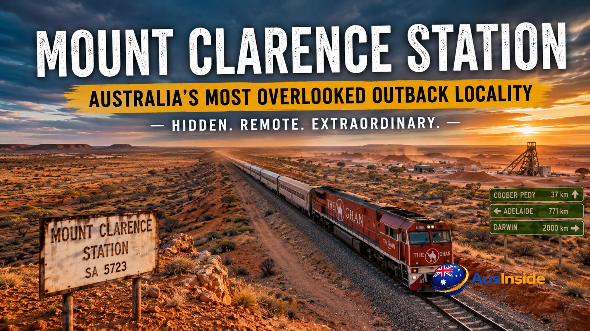
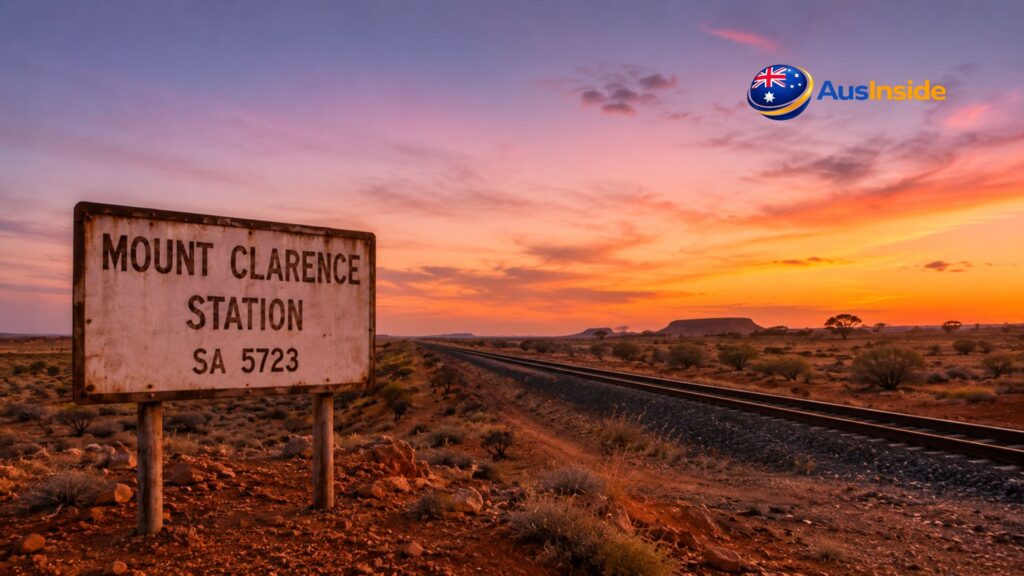
Mount Clarence Station is one of those places.
And yet, the more you dig into it, the more it becomes apparent that this remote South Australian locality is sitting at the intersection of an extraordinary number of stories — geological, colonial, ecological, industrial, and spiritual. There’s a railway here that changed the way Australia connected its north and south. There’s a highway here that was originally carved through the desert to support British nuclear weapons testing. There’s an ancient seabed beneath the dirt that produces the finest opals on earth just 37 kilometres to the east. And there are Aboriginal Australians whose ancestors walked this country for tens of thousands of years before a single European set foot in it.
The locality itself — formalised with official boundaries only on 26 April 2013 — covers more than 10,600 square kilometres of South Australia’s Far North region. According to the 2016 census, it shares a population of approximately ten people with adjacent localities. Ten. The number doesn’t convey desolation so much as it conveys scale — a scale so vast that ordinary human metrics stop making useful sense.
This is a full account of Mount Clarence Station: its land, its history, its geology, its railways, its nuclear secrets, its explorers, and what it actually means to live and travel in a place the modern world largely doesn’t know exists.
Have A Look On It: Bella Vista Metro Station
- Quick Facts
- The Lay of the Land — Geography, Location and the Coordinates That Tell You Everything
- The Geological Story: A Hundred Million Years Before Anyone Arrived
- The First Humans — Anangu Country and Forty Thousand Years of Knowing This Land
- John McDouall Stuart — The Man Who Named This Country for Europeans
- The Pastoral Station: What It Actually Means to Run Country Like This
- The Nuclear Secret in the Western Desert — Len Beadell and the Road That Wasn't What It Seemed
- Manguri Siding — Where Thousands of Tourists Step Into the Middle of the Outback
- The Town of Manguri — A Planned Settlement the Desert Refused to Keep
- The Anne Beadell Highway — What the Road Actually Demands of You
- The Ecology of the Place — What Actually Lives in 10,000 Square Kilometres of Outback
- Practical Facts for Travellers — What You Need to Know Before Going
- Things Every Other Article Gets Wrong About This Locality
- Key Facts at a Glance
- Frequently Asked Questions
Quick Facts
| Fact | Details |
|---|---|
| Official Name | Mount Clarence Station |
| State | South Australia |
| Region | Far North South Australia |
| Postcode | 5723 |
| Coordinates | 29°05′39″S 134°34′29″E |
| Area | 10,617 km² |
| Population | Approximately 10 residents (2016 Census) |
| Local Government | Pastoral Unincorporated Area |
| Governing Authority | Outback Communities Authority |
| State Electorate | Giles |
| Federal Division | Grey |
| Time Zone | Australian Central Standard Time (UTC+9:30) |
| Nearest Town | Coober Pedy |
| Main Railway Stop | Manguri Siding |
| Primary Industry | Pastoral Grazing |
| Locality Established | 26 April 2013 |
The Lay of the Land — Geography, Location and the Coordinates That Tell You Everything
Coordinates: 29°05′39″S 134°34′29″E.
Postcode: 5723.
Time zone: Australian Central Standard Time (UTC+9:30).
Local Government: Pastoral Unincorporated Area, administered under the Outback Communities Authority.
State electorate: Giles. Federal division: Grey — the largest federal electorate in Australia by area, covering 1.63 million square kilometres.
Mount Clarence Station lies roughly 771 kilometres north-west of Adelaide, situated to the west of the Stuart Highway — that long red thread of bitumen that stitches together the continent from Port Augusta in the south all the way to Darwin in the north. The locality’s eastern boundary roughly shadows the highway. Two state-maintained roads provide access from the east: the Anne Beadell Highway enters from the south, and Mount Clarence Road enters from the north. The Anne Beadell continues westward across the Adelaide–Darwin railway line and terminates at the Mabel Creek homestead, where it then resumes as an unofficial track pushing deeper into some of the most remote country on the continent.
The Adelaide–Darwin railway corridor runs from south to north through the western side of the locality. Near its passage through the property, a siding named Manguri sits close to the site of an old government town, also called Manguri, that once existed as a planned settlement in this stretch of desert.
The Coober Pedy opal fields — the most productive precious opal deposit on earth — sit 37 kilometres to the east. The Breakaways Reserve, a dramatic landscape of flat-topped mesas and multicoloured geological strata, lies to the northeast. And beyond the western boundary of the locality, the land transitions into increasingly remote desert country — dunes, claypans, spinifex, silence.
This is not marginal outback. This is the heart of it.
| Year | Event |
|---|
| ~100 Million Years Ago | Area lies beneath the ancient Eromanga Sea |
| 40,000+ Years Ago | Anangu peoples occupy and manage the region |
| 1858 | Explorer John McDouall Stuart passes through the Stuart Range region |
| Late 1800s | Pastoral leases begin expanding across Far North South Australia |
| 1915 | Opal discovered near Coober Pedy |
| 1953 | Len Beadell constructs first section of road toward Emu Field |
| 1953 | British Operation Totem nuclear tests conducted at Emu Field |
| 1962 | Anne Beadell Highway construction completed |
| 1978 | Manguri officially named as a railway siding |
| 1980 | Tarcoola–Alice Springs railway opens |
| 2004 | Adelaide–Darwin railway completed, expanding The Ghan route |
| 2013 | Mount Clarence Station gazetted as an official locality |
| 2016 | Census records shared population of approximately 10 residents |
Google Map View
The Geological Story: A Hundred Million Years Before Anyone Arrived
To understand Mount Clarence Station — and the country surrounding it — you need to go back about 100 million years. Because the land you’re walking on here was once the floor of a shallow inland sea.
During the Early Cretaceous period, a vast body of water called the Eromanga Sea covered an enormous swath of central Australia. This was a warm, relatively shallow marine environment, and as organisms lived and died in it, layer upon layer of fine sediment accumulated on the seafloor. These sediments — marine mudstones, claystones, and siltstones — became the formation geologists now call the Bulldog Shale: a sequence of Early Cretaceous rocks, 200 to 340 metres thick in places, that sits beneath much of the surrounding country.
The Bulldog Shale is directly responsible for the opal fields of Coober Pedy. Around 30 million years ago, as the Australian continent shifted northward and the old seabed was uplifted and exposed to deep weathering, silica dissolved out of the rock and was carried downward through groundwater. Where pressure, temperature, and chemistry aligned perfectly, that silica precipitated and hardened — not as quartz, but as amorphous silica: opal. The precious kind, with its shifting play of colour, formed where the silica infiltrated cracks, joints, and voids within the deeply weathered Bulldog Shale, typically within 50 metres of the surface.
The Stuart Range escarpment, which passes within 10 kilometres of Coober Pedy and defines the western margin of the Great Artesian Basin in this region, is where those opal-bearing strata are exposed. It is named for John McDouall Stuart, the Scottish-born explorer who first traversed this country in 1858 — and who, according to one historical account, did not realise the immense wealth of opal concealed beneath the peculiar flinty stones that were lacerating his horses’ hooves as he pushed through.
The Bulldog Shale also produced something else. During the Cretaceous, when this was polar sea — cold, low-oxygen water, far south of the equator — marine reptiles lived and died here. Several remarkable fossils have been found in this formation, including the plesiosaur Umoonasaurus, recovered from opal mines near Coober Pedy and preserved, literally, in precious opal instead of stone. When people say the geological history of this region is extraordinary, that’s what they mean: the same process that created the world’s most famous opal field also preserved its ancient sea creatures in the gemstone itself.
Mount Clarence Station sits on the western fringe of this geological province. Whether it contains opal-bearing strata remains largely unexplored — the pastoral lease predates any significant mineral survey of this specific portion of the property.
| Climate Factor | Details |
|---|
| Climate Type | Arid Desert Climate |
| Summer Temperatures | 40–50°C |
| Winter Day Temperatures | 18–25°C |
| Winter Night Temperatures | 0–5°C |
| Average Annual Rainfall | ~175 mm |
| Wettest Period | Irregular thunderstorms throughout the year |
| Driest Conditions | Extended drought periods are common |
| Best Time to Visit | March to September |
| Summer Travel Risk | Extreme heat and remote conditions |
| Sky Conditions | Exceptional stargazing with virtually no light pollution |
The First Humans — Anangu Country and Forty Thousand Years of Knowing This Land
Before any European set foot here, before any pastoral lease, before any railway, before any highway — this was Anangu country.
The Anangu — the Aboriginal peoples of central and western Australia — walked this landscape for at least 40,000 years, possibly considerably longer. Their knowledge of it was, and remains, extraordinary in its depth. They knew every waterhole. They knew which plants signalled rain. They knew the songlines — those oral navigational traditions that encode geographic, ecological, and spiritual knowledge in ceremony and story — that connected this country to places hundreds of kilometres distant.
The Far North of South Australia is crisscrossed by songlines. The landscape was not empty, wild, or unknown. It was meticulously mapped, named, and understood in ways that European surveyors with their theodolites and sketch pads could not approach.
This matters to the story of Mount Clarence Station because the pastoral occupation of this land was imposed on an existing world. The Mabel Creek homestead to the north-west of the locality — where the Anne Beadell Highway terminates in its state-maintained form — is now actually owned by the Antakirinja Matu-Yankunytjatjara, the Aboriginal traditional owners of the area, and is operated under a pastoral sub-lease. That is not a footnote. That is the land returning, in a material legal sense, to its first custodians.
The Antakirinja Matu-Yankunytjatjara hold native title over large portions of the country surrounding Mount Clarence Station. The landscape that appears empty and uninhabited to passing visitors is, in the framework of its oldest knowledge system, densely populated with meaning, story, and connection.
John McDouall Stuart — The Man Who Named This Country for Europeans
The Stuart Range, which defines much of the regional landscape around Mount Clarence Station, takes its name from John McDouall Stuart: a Scottish-born surveyor who arrived in South Australia in 1839, joined Charles Sturt’s 1844 expedition to the interior as draughtsman, and subsequently became arguably the greatest inland explorer in Australian history.
Stuart’s first expedition in 1858 — just three men, six horses, and a month’s provisions — departed from the Flinders Ranges and pushed north-west into country no European had seen. He passed through the area that would become the Stuart Range, naming the range as he went. What he observed was a low upland with a north-west to south-east alignment, passing close to what is now Coober Pedy. He noted the flinty stones causing damage to his horses. He did not find water easily. He turned back due to provisions.
Over the following four years, Stuart mounted five more expeditions, each more ambitious than the last. In 1862 he became the first European to cross Australia from south to north and return alive — a feat that cost him his health, his eyesight, and ultimately his life (he died in 1866 at 50 years old, partially blind from sun damage sustained on those desert crossings).
The Stuart Highway, which passes to the east of Mount Clarence Station, follows the general route he established. The railway line that cuts through the western edge of the locality runs parallel to it. When you drive north on the Stuart Highway past Coober Pedy and continue through this country, you are following the track of a man who completed one of the most physically gruelling journeys in the history of exploration — driven largely by curiosity, stubbornness, and an apparently extraordinary ability to read a landscape.
The pastoral history of Far North South Australia owes its very existence to Stuart’s expeditions. European settlers followed his routes, identified the country he described as suitable for grazing, and took up pastoral leases throughout the second half of the 19th century. Mount Clarence Station is part of that pattern.
The Pastoral Station: What It Actually Means to Run Country Like This
The word “station” in an Australian context means a large pastoral property — a working farm of cattle or sheep, often covering thousands of square kilometres, operating in country where rainfall is unreliable and the distances between places are measured in hours of driving rather than minutes.
Mount Clarence Station’s boundaries align approximately with those of the pastoral lease from which the locality takes its name. The exact date the original lease was taken up is not precisely documented in publicly available records, but the broader pattern of pastoral settlement in the Far North of South Australia suggests that most leases in this region were established in the late 19th and early 20th centuries, often prompted by the expansion of the old Ghan railway line and the access it provided to otherwise unreachable country.
Pastoral leases in South Australia’s Pastoral Unincorporated Area operate under specific regulations administered by the state government. Lessees hold rights to graze livestock but do not own the land outright — crucially, they hold no rights to minerals beneath the surface. That distinction becomes pointed when you consider that the pastoral lease covering Mount Clarence Station sits within 37 kilometres of the world’s most productive opal field.
Running country in the Far North is not agriculture in any sense that most Australians would recognise from more temperate regions. The vegetation — bluebush, saltbush, scattered mulga and native pine — provides sparse but real grazing, particularly for sheep and goats. Water comes from artesian bores, rainwater tanks, and the occasional creek. Power is generated on-site. Medical care is provided by the Royal Flying Doctor Service out of Port Augusta. Education for children happens through distance learning, now conducted largely online.
The practical reality of station life here is self-sufficiency by necessity. Everything has to be thought through in advance: fuel, parts, medicines, food for weeks at a time. When something breaks — a bore pump, a vehicle gearbox, a satellite dish — you either fix it yourself or wait days for someone to come. The people who live and work in this country develop a competence and calmness about practical problems that is genuinely impressive to observe.
The 2016 census figure of ten people across Mount Clarence Station and adjacent localities is a number that rewards reflection. That is ten people distributed across more than 10,600 square kilometres. The Australian Capital Territory — home to Canberra, a national capital — covers approximately 2,358 square kilometres and has a population of over 400,000. Mount Clarence Station is four times larger by area, and has ten people.
The Nuclear Secret in the Western Desert — Len Beadell and the Road That Wasn’t What It Seemed
The Anne Beadell Highway enters the Mount Clarence Station locality from the south. In its state-maintained section — from the Stuart Highway junction near Coober Pedy to the Mabel Creek homestead — it is a graded outback road, navigable in a well-prepared vehicle. Beyond Mabel Creek, heading west, it becomes one of the most challenging unsealed tracks in Australia.
The highway is named after Anne Beadell, wife of Len Beadell — and the story of its construction is one of the most unusual and under-told chapters in recent Australian history.
Len Beadell was a surveyor, road builder, author, and — by most accounts — one of the most genuinely characterful figures in 20th century Australia. Born in 1923, he spent his career constructing over 6,500 kilometres of tracks across the arid interior of the continent. But the reason he was carving roads through this country wasn’t tourism. It was weapons.
In 1952, Beadell was tasked by the Australian Department of Supply with finding a suitable site for British atomic weapons testing. He identified Emu Field — a flat claypan in remote South Australia, approximately 290 kilometres north-northwest of Woomera. In February and March 1953, he built a 200-kilometre access road from Mabel Creek Station — directly adjacent to Mount Clarence Station — west towards Emu Field. This was the very first section of what would eventually become the Anne Beadell Highway.
The road was constructed specifically so that British nuclear scientists, military personnel, and support equipment could reach the test site. In October 1953, Operation Totem — two nuclear detonations on steel towers in the desert — took place at Emu Field. The devices were plutonium bombs of 9.1 and 7.1 kilotons respectively. A phenomenon known as “black mist” — a toxic cloud of radioactive particles — rolled across the landscape after one of the detonations, affecting Aboriginal communities whose presence in the region had been largely ignored in the planning of the tests. The health consequences were real and lasting, and are still being documented and debated.
After Emu Field proved problematic — too remote, water supply issues — Beadell identified a second test site at Maralinga, further south, and continued building roads to support the broader weapons research network in the desert. Over the following decade, his Gunbarrel Road Construction Party built the full highway network that now bears his family’s name.
What this means for Mount Clarence Station is striking: the access road that enters the locality from the south was literally the first road ever built into this part of the desert, and it was built to support nuclear weapons testing. The pastoral stations along its route — including the country surrounding Mount Clarence Station — were the staging posts for one of the most controversial chapters in modern Australian history.
The Emu Field test site itself can be visited today, with written approval from the RAAF Woomera Range Complex, via the Anne Beadell Highway. Stone monuments mark the ground-zero points. Vitrified sand — glassy material created by the heat of the nuclear detonations — can still be found there. The concentric blast rings are visible.
Manguri Siding — Where Thousands of Tourists Step Into the Middle of the Outback
On 18 May 1978, the South Australian Government Gazette published a simple announcement: nine names would be assigned to rail sidings along the proposed Tarcoola to Alice Springs railway line. One of those names was Manguri.
The Tarcoola–Alice Springs railway was completed in 1980, replacing the old narrow-gauge Ghan route — a famously unreliable line that ran through flood-prone country to the east and was regularly cut off for weeks at a time. The new alignment was built further west, through drier, more stable terrain. It passed through the western side of Mount Clarence Station and created Manguri Siding in the process.
For most of its early existence, Manguri was a functional freight siding — a place where trains could cross and continue, notable only for its extreme remoteness. The siding sits approximately 42 kilometres west of Coober Pedy, in the middle of the absolute desert, with no permanent settlement nearby.
Then The Ghan changed everything.
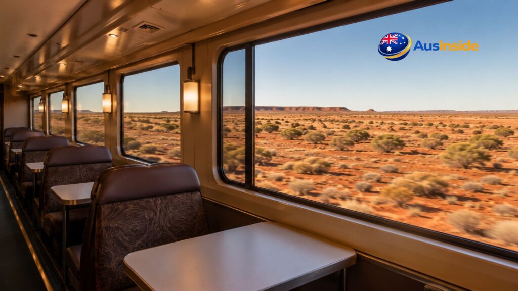
The Ghan — the legendary transcontinental passenger train that runs between Adelaide and Darwin — was extended from Alice Springs to Darwin in 2004. The completion of the full 2,979-kilometre route transformed it from a regional service into one of the great railway journeys of the world. As the experiential tourism product around it developed, Manguri became one of the most dramatic stops on the journey.
On the Ghan Expedition — the multi-day touring variant — passengers wake up at Manguri on the outbound northbound journey. The train has pulled into the siding overnight. When the carriage blinds come up, passengers find themselves looking at a landscape of absolute, unbroken desert. There is nothing. Just the red earth, the scrub, the blue sky, and silence.
Coaches then take those passengers 42 kilometres into Coober Pedy for a full-day excursion: underground churches, opal mines carved into the hillside, a gourmet lunch eaten below the earth’s surface, and an afternoon at the Breakaways Reserve — that extraordinary landscape of flat-topped mesas, coloured in ochre and white and rust, that looks like a painter’s palette left in the sun.
On some southbound journeys in March and November, The Ghan arrives at Manguri after dinner. Passengers are invited off the train to stand beside an open bonfire under the clearest sky most of them have ever seen. With zero light pollution from any direction, the stars above Mount Clarence Station form a carpet so dense it’s difficult to individually distinguish them. Travel writers who’ve described this stop consistently reach for words like “impossible” and “unlike anything.”
It is, objectively, one of the more extraordinary rail experiences available anywhere on earth.
The Anne Beadell Highway, which crosses the railway line near Manguri, has a practical note for travellers: the state-maintained eastern section from the Stuart Highway to Mabel Creek is generally accessible in a well-prepared 4WD, but road conditions should be checked in advance, particularly after summer rains.
The Town of Manguri — A Planned Settlement the Desert Refused to Keep
There is a detail that almost every article about Mount Clarence Station misses entirely: Manguri Siding sits near the site of a former planned government town.
The government town of Manguri was established in connection with the railway construction and the broader administrative expectations around the new Tarcoola–Alice Springs line. It was intended to house workers and provide a service node in this remote country. Maps of the area still show its location, and the South Australian government’s Location SA mapping system references it as a feature near the Manguri Siding.
It didn’t last. The climate — 45-degree summer days, freezing winter nights, annual rainfall measured in the low double-digit millimetres — combined with the fundamental difficulty of sustaining a town this far from anywhere eventually defeated the planning assumptions. Manguri the town didn’t become Manguri the thriving outback community. It became the site of a railway siding, a bonfire, and a remarkable view of the stars.
This is not an uncommon story in South Australia’s Far North. The region is littered with the ambitions of planners who underestimated the desert. Farina, 200 kilometres to the south-east, was surveyed in 1876 with straight streets and generous town blocks, intended to become a thriving agricultural centre. The climate had a different view. It’s a ghost town now.
The country around Mount Clarence Station has a way of outlasting human plans. The pastoral station endures because it adapted to what the land can actually sustain, not what optimistic reports suggested it might. That long-term pragmatism — running the right number of animals over a vast area rather than intensively farming a concentrated plot — is what makes pastoral station culture in the Australian outback so durable and so distinct.
The Anne Beadell Highway — What the Road Actually Demands of You
For travellers planning the full Anne Beadell crossing — from the Stuart Highway near Coober Pedy all the way to Laverton in Western Australia, a total of 1,325 kilometres — Mount Clarence Station is the staging area.
Let’s be concrete about what the Anne Beadell demands. Len Beadell surveyed it between 1953 and 1962, and after he finished, the South Australian section was never graded or maintained. Not once in its 60-year life. The track is soft sand over significant portions, with corrugations on the stonier sections that can rattle a vehicle apart if you push too hard. The scrub encroaches from both sides, and in places the track narrows to the point where external fittings and paintwork are at risk from overhanging branches.
You need four permits to travel the full highway. The permits cover Aboriginal-owned land through which significant portions of the track pass — the traditional custodians of this country include several different groups depending on which section you’re crossing.
There is one fuel stop between Coober Pedy and Laverton: the Ilkurlka Roadhouse at 700 kilometres from Coober Pedy and 625 kilometres from Laverton, operated by the Tjuntjuntjara Aboriginal community. Beyond that, you carry everything. Fuel calculations are not approximate exercises on this track — they are life-safety decisions. Satellite communications are mandatory. In good conditions, experienced drivers allow five full days to complete the crossing.
Summer travel is effectively prohibited by temperature. The desert here reaches 50°C in summer, and those temperatures are not merely uncomfortable — they are lethal to engines, tyres, humans, and any margin for error. March to September is the window.
The first section — from Coober Pedy west through the Mount Clarence Station locality to Mabel Creek — is the easiest portion of the full highway and is state-maintained. But even this section should not be treated casually. There are no services between the Stuart Highway and Mabel Creek, and the road condition varies. The dog fence — an old boundary fence that once marked the transition from dingo-prone to dingo-free country — crosses the highway near here, and beyond it the track characteristics change.
For four-wheel drivers willing to put in the preparation, the Anne Beadell is one of the genuinely great outback crossings. The Emu Field claypan — site of those 1953 nuclear tests — is accessible from a side track. The geology changes from the red sand and gibber plains of South Australia into the more dramatic dune country of the Western Australian border. And for much of the crossing, particularly the 780 kilometres between Ilkurlka and Coober Pedy, there is not another human being within reach.
| Destination | Distance from Mount Clarence Station |
|---|
| Coober Pedy | 37 km east |
| Manguri Siding | Within the locality |
| Breakaways Reserve | Approximately 65 km |
| Mabel Creek Homestead | Approximately 40 km |
| Port Augusta | Approximately 530 km |
| Adelaide | Approximately 771 km |
| Alice Springs | Approximately 700 km |
| Darwin | Approximately 2,000 km |
| Emu Field Nuclear Test Site | Approximately 170 km west |
| Laverton (WA) | Approximately 1,325 km via Anne Beadell Highway |
The Ecology of the Place — What Actually Lives in 10,000 Square Kilometres of Outback
It’s worth correcting a common assumption about this country: it is not ecologically empty.
The land within and around Mount Clarence Station sits within the Tirari–Sturt stony desert ecoregion, characterised by gibber plains (those flat expanses of polished stones that reflect and radiate heat), red sand plains, mulga woodland, and spinifex grassland. The vegetation appears sparse from a car window, but it represents a precisely adapted ecological community.
Saltbush and bluebush dominate the shrub layer across most of the station, providing both ground cover and grazing fodder for livestock. Mulga (Acacia aneura) forms low open woodland on the sandier soils. In the rocky areas, native pines — Callitris species — appear. After significant rainfall events, the area undergoes a transformation that visitors who’ve only seen it in dry years find difficult to believe: annual wildflowers, including daisies and everlastings, appear in drifts of colour across the gibber plains, attracting enormous numbers of birds.
The bird fauna of this region is exceptional in its diversity precisely because of that boom-bust ecology. During good seasons, waterbirds arrive at temporary wetlands from hundreds of kilometres away. Raptors — wedge-tailed eagles, brown falcons, little eagles — are a constant presence. Budgerigars move through in flocks that can number in the thousands. In the dry years between these events, the bird life is quieter but still present: chestnut-crowned babblers, crimson chats, various thornbills, white-winged trillers.
The reptile community is extraordinary and largely invisible to casual visitors: goannas, thorny devils, bearded dragons, blue-tongue lizards, and a diverse assemblage of gecko species emerge at dawn and dusk. King brown snakes — among the most venomous species in the world — are present throughout. They are shy, not aggressive, but the advice is to watch where you step in thick spinifex and around rockpiles.
Feral camels are a notable and problematic feature of this landscape. Introduced in the 19th century to support exploration and transport, they thrived in conditions that perfectly matched their desert origins. The population grew to over a million animals before serious management efforts began in the early 21st century. They damage fences, foul waterholes, and compete with livestock for grazing. Managing feral camels is a significant practical burden for pastoral stations across the Far North.
| Attraction | Distance | Why Visit |
|---|
| Coober Pedy | 37 km east | World-famous opal mining town with underground homes |
| Manguri Siding | Within locality | Iconic stop on The Ghan railway journey |
| Breakaways Reserve | ~65 km | Stunning mesas, desert landscapes and sunset views |
| Stuart Highway | Adjacent east | Australia’s legendary north–south highway |
| Anne Beadell Highway | Starts within locality | One of Australia’s most remote 4WD routes |
| Emu Field | ~170 km west | Historic British nuclear testing site |
| Dog Fence | Nearby | One of the world’s longest fences |
| Umoona Opal Mine & Museum | 37 km | Learn about opal mining and local history |
| Serbian Orthodox Underground Church | 37 km | Unique underground religious landmark |
| Kanku-Breakaways Conservation Park | ~65 km | Spectacular geological formations and Aboriginal heritage |
Practical Facts for Travellers — What You Need to Know Before Going
Climate: Extreme, without apology. Summer temperatures exceed 40°C regularly and can approach 50°C. Winter nights drop close to freezing. The annual average rainfall across the Coober Pedy region is approximately 175mm — but the word “average” is misleading. The desert doesn’t distribute its rain evenly across years. It tends to deliver nothing for extended periods and then dump a significant event in a single storm. Road conditions can change completely after rain.
Access: The Stuart Highway passes 37 kilometres east of the locality at Coober Pedy. The Anne Beadell Highway (state-maintained section) and Mount Clarence Road connect the locality to the highway. Both require a high-clearance vehicle. The Anne Beadell Highway westward from Mabel Creek requires a genuine 4WD with appropriate preparation.
The Ghan: If you’re travelling on the Ghan Expedition between Adelaide and Darwin, Manguri Siding within the locality is an off-train experience stop. Passengers disembark for the Coober Pedy day excursion. The bonfire evening stop at Manguri on southbound winter journeys is a separate, highly memorable event. Booking through Journey Beyond Rail at journeybeyondrail.com.au.
Visiting the pastoral station itself: Mount Clarence Station is a working pastoral lease on private land. Public access is not permitted across the station without prior arrangement with the leaseholders. The state-maintained roads through the locality are public corridors, but the surrounding land is not.
The Breakaways Reserve: Located approximately 30 kilometres north of Coober Pedy and accessible as a day trip, the Breakaways are one of the most visually striking landscapes in South Australia — flat-topped mesas in layers of white, ochre, and deep red that feel genuinely otherworldly. Desert Parks Pass required.
Emergency services: The Royal Flying Doctor Service operates out of Port Augusta and Broken Hill. Mobile phone coverage on the Stuart Highway extends for some distance but disappears quickly into the station country. A satellite phone or personal locator beacon is not a luxury in this part of Australia — it is the single most important safety item you can carry.
Things Every Other Article Gets Wrong About This Locality
There are consistent errors and omissions in the limited published information about Mount Clarence Station.
The first: presenting Manguri Siding as the key defining feature of the locality without explaining why it exists. It exists because of a railway that was built in the late 1970s to replace a flood-prone earlier route, and it sits where it sits because of the position of the pastoral station relative to Coober Pedy. The siding’s role in tourism is recent — a product of how The Ghan’s experiential tourism product evolved after the Darwin extension in 2004.
The second: describing the Anne Beadell Highway without explaining its origin. This is not merely a remote outback road that adventurous 4WD drivers use. It was purpose-built to support nuclear weapons testing and connects directly to one of the most contested episodes in 20th century Australian history.
The third: treating the population figure of “approximately ten people” as a curiosity without contextualising what it means in practice. A population of ten across 10,600 square kilometres creates specific realities: governance by the Outback Communities Authority rather than a conventional council; education delivered remotely; medical care provided by the Flying Doctor; road maintenance performed by state contractors who service vast networks on infrequent schedules; no local emergency services; social connection maintained through trip-making and radio rather than local community gathering.
The fourth: the geological story. The Bulldog Shale that produced Coober Pedy’s opals runs beneath the locality. The ancient Eromanga Sea that deposited it was not a distant phenomenon — it was here, exactly here, 100 million years ago. The land of Mount Clarence Station was the floor of that sea.
The fifth: the Aboriginal history. No article on this locality adequately accounts for the depth and continuity of Anangu presence in this country — including the fact that Mabel Creek homestead, directly adjacent to the locality, is now owned by the Antakirinja Matu-Yankunytjatjara traditional owners.
Key Facts at a Glance
- Locality established: 26 April 2013
- Coordinates: 29°05′39″S 134°34′29″E
- Postcode: 5723
- Area: 10,617 square kilometres
- Population: ~10 (shared with adjacent localities, 2016 census)
- Distance from Adelaide: 771 km north-west
- Distance from Coober Pedy: 37 km west
- Railway: Adelaide–Darwin corridor; Manguri Siding within the locality
- Roads: Anne Beadell Highway (south entry), Mount Clarence Road (north entry)
- Governance: Pastoral Unincorporated Area / Outback Communities Authority
- State electorate: Giles
- Federal division: Grey
- Geology: Western margin, Eromanga Basin; Bulldog Shale formation beneath
- Nearest town: Coober Pedy
- Nearest emergency services: Royal Flying Doctor Service (Port Augusta base)
Don’t Forget To Read It: Hills Showground Station
Frequently Asked Questions
What is Mount Clarence Station and why does it have that name?
Mount Clarence Station is a formal locality in the Far North region of South Australia, gazetted on 26 April 2013. Its boundaries align approximately with those of the pastoral station of the same name — a working pastoral lease that has operated in this country for many decades. The word “Station” was deliberately included in the official locality name to distinguish it from Mount Clarence in Albany, Western Australia, which is a historically significant hilltop associated with ANZAC memorial services — an entirely different place and context. Without the distinguishing suffix, address and geographic records would create confusion.
What is Manguri Siding and how does The Ghan use it?
Manguri Siding is a railway siding on the Adelaide–Darwin rail corridor, located within the Mount Clarence Station locality approximately 42 kilometres west of Coober Pedy. Named in 1978 and operational from 1980, it serves as the disembarkation point for Ghan Expedition passengers who travel by coach into Coober Pedy for day excursions. On some southbound winter journeys, The Ghan also stops here after dinner for a bonfire experience under the outback night sky — a stop noted for its extraordinary stargazing, with zero light pollution in any direction.
Is the Anne Beadell Highway safe for regular travellers?
The state-maintained eastern section — from the Stuart Highway junction near Coober Pedy to Mabel Creek — is accessible in a high-clearance vehicle, though road conditions vary and local advice should be sought before travel, particularly after rain. The full highway west to Laverton (1,325 km total) is strictly for experienced 4WD travellers with comprehensive preparation: four separate permits, satellite communications, large fuel reserves, and significant supplies. Summer travel is inadvisable due to temperatures that regularly reach 50°C. The track traverses Aboriginal-owned land through much of its length, and respecting the permit process is not optional.
What is the geological significance of the land around Mount Clarence Station?
The locality sits on the western margin of the Eromanga Basin, underlain by Early Cretaceous Bulldog Shale — the same geological formation that produced the precious opal deposits at Coober Pedy, 37 kilometres to the east. This shale was deposited approximately 100 million years ago on the floor of the Eromanga Sea, a vast shallow inland sea that covered central Australia during the Cretaceous period. Subsequent geological uplift, deep weathering, and silica precipitation created the opal fields. The same strata have also preserved remarkable Cretaceous marine fossils — including the plesiosaur Umoonasaurus, found opalized in the Coober Pedy fields.
What connection does Mount Clarence Station have to British nuclear testing?
The Anne Beadell Highway’s first section — from Mabel Creek Station westward toward Emu Field — was constructed in 1953 by Len Beadell specifically to provide access for British nuclear weapons tests. Operation Totem, which detonated two nuclear devices at Emu Field in October 1953, was accessed via this road. The Mabel Creek homestead lies adjacent to Mount Clarence Station, meaning the nuclear weapons logistics chain for those tests ran directly through this locality. The Emu Field test site can be visited today via the Anne Beadell Highway with RAAF permission, and stone monuments mark the ground-zero points.
Can you visit the Breakaways Reserve from Mount Clarence Station?
The Breakaways Reserve is located approximately 30 kilometres north of Coober Pedy, accessible via the Stuart Highway. It is not within the Mount Clarence Station locality but is in the immediate regional vicinity. The reserve requires a Desert Parks Pass from the South Australian National Parks and Wildlife Service. It is one of the most visually striking landscapes in the state — flat-topped mesa formations in vivid ochre, red, and white — and is included in The Ghan Expedition’s Coober Pedy excursion program.
What wildlife can you expect in and around the locality?
The area supports a diverse ecology. Wedge-tailed eagles and other raptors are common. After rainfall, budgerigar flocks and waterbirds can appear in large numbers. Reptile diversity is high — goannas, thorny devils, bearded dragons, and various geckoes, plus several venomous snake species. Feral camels are present throughout the region and represent both a visual spectacle and a significant management problem for pastoral operators. Wildflowers appear after good rainfall events, transforming the gibber plains dramatically. The boom-bust ecology of arid Australia means that what you see depends heavily on recent rainfall history.
Who governs Mount Clarence Station as a locality?
The locality falls within the Pastoral Unincorporated Area, which has no conventional local council. Municipal-style services are provided directly by the South Australian Government through the Outback Communities Authority. At state level, the locality sits within the electoral district of Giles, which covers an enormous portion of outback South Australia. Federally, it falls within the Division of Grey — Australia’s largest federal electorate by area, covering approximately 1.63 million square kilometres, stretching from the northern coast of the Eyre Peninsula to the Northern Territory border.