
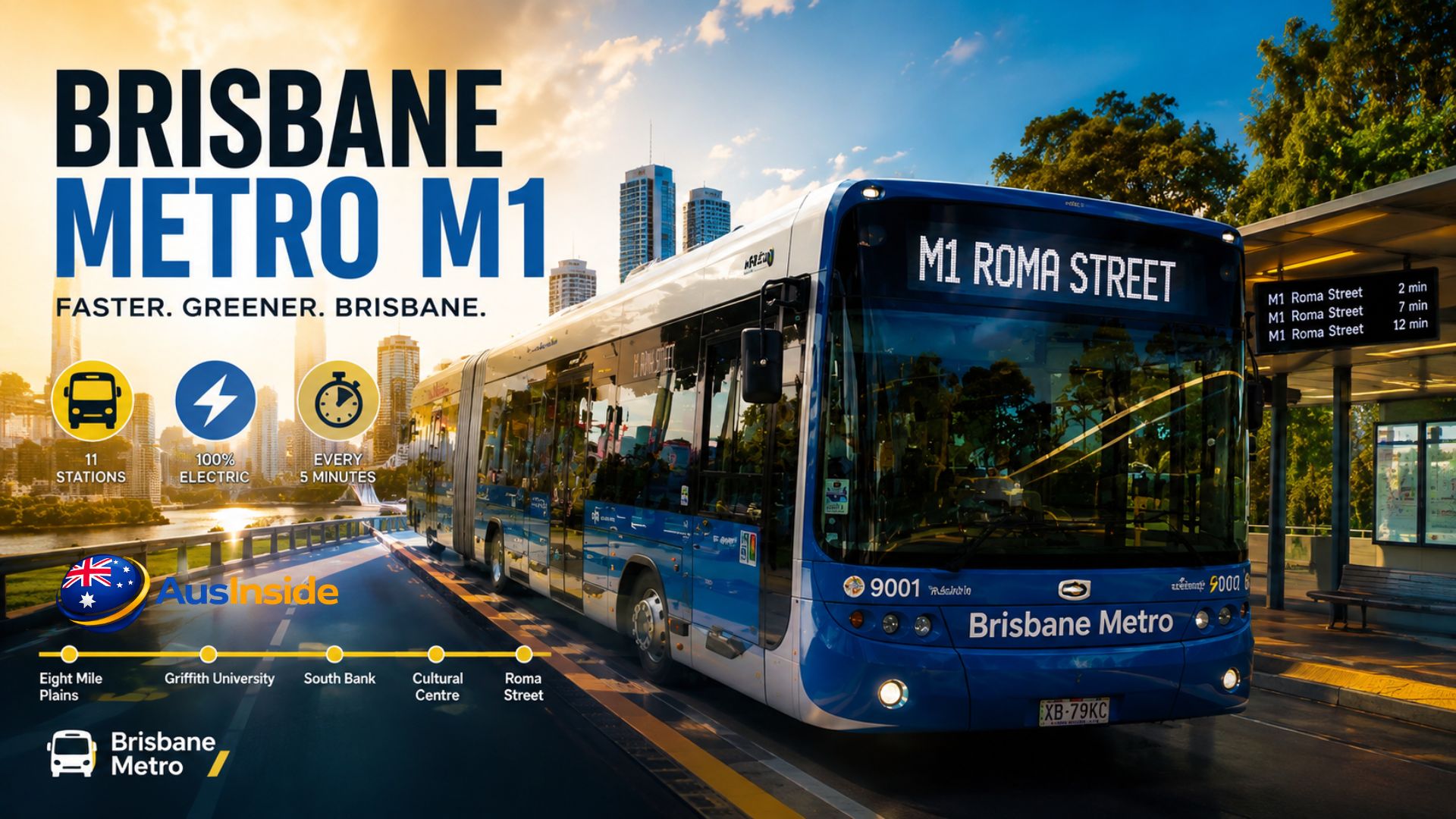
The M1 is Brisbane’s busiest metro route, running 17 kilometres between Eight Mile Plains and Roma Street across 11 stations, every 5 minutes on weekdays. It replaced bus routes 111 and 160 on 30 June 2025, and it costs a flat 50 cents a trip with a go card or contactless card. That’s the short version. Everything below is what you actually need once you’re standing on a platform trying to work out which direction to walk.
We’ve ridden the M1 end to end multiple times across weekday peak, weekend, and event days, cross-checked the official station list against TransLink’s live departure data, and pulled the verified project history most guides either get wrong or skip entirely — including why it doesn’t stop at Woolloongabba, and why that trips up more first-time riders than anything else on the route.
- What Is Brisbane Metro M1?
- M1 Route Map: All 11 Stations in Order
- M1 Timetable and Frequency
- M1 Fares: What You'll Actually Pay
- The M1 Vehicle: What You're Actually Riding
- How M1 Replaced Routes 111 and 160
- What Most Guides Get Wrong About M1
- How to Ride M1: Step-by-Step
- Best Things to Do Along the M1 Route
- M1 Reliability: On-Time Performance and Known Bottlenecks
- M1 vs M2: Quick Comparison
- Future of M1: The Springwood Extension
- FAQs
What Is Brisbane Metro M1?
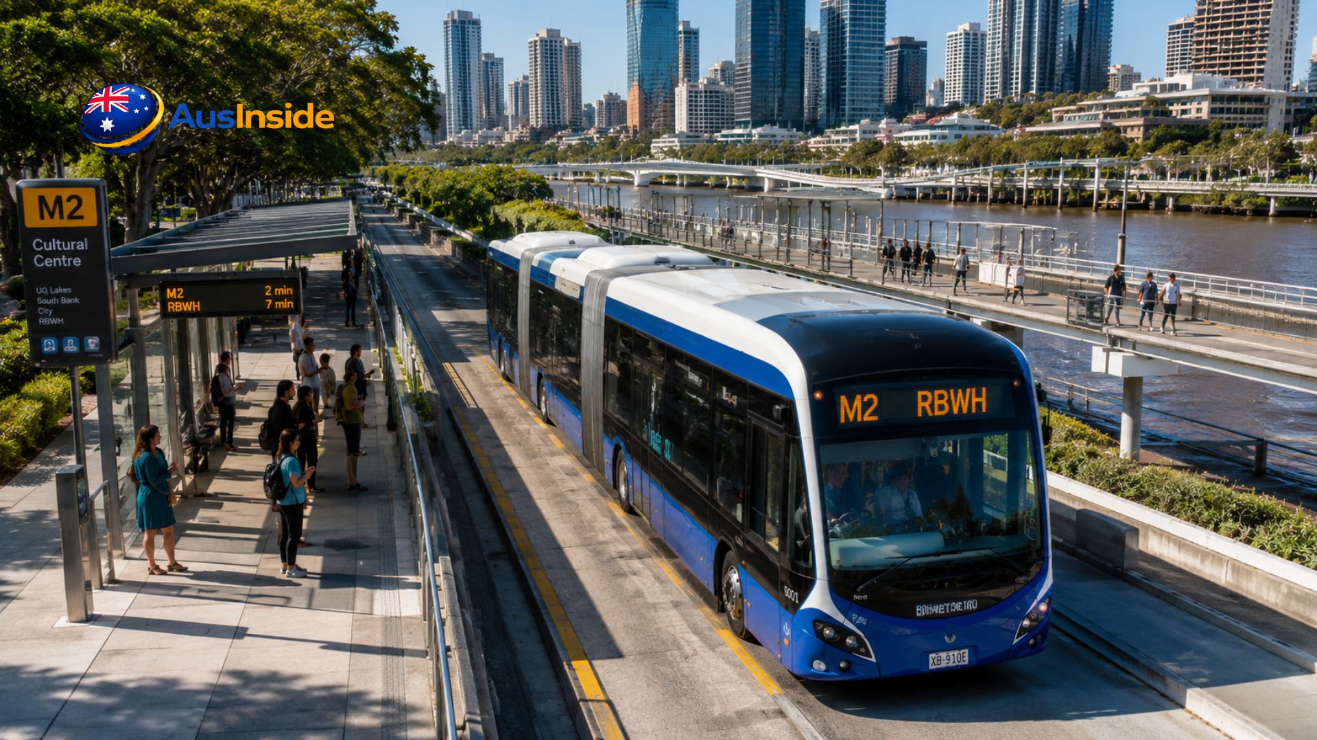
M1 is one of two high-frequency electric bus routes that make up Brisbane Metro — a bus rapid transit (BRT) system, not a train or tram, despite the name. It runs on the existing South East Busway, using 24.4-metre bi-articulated electric buses instead of standard vehicles. M1 connects Eight Mile Plains in the south to Roma Street in the CBD, replacing what used to be routes 111 and 160.
Its sister route, M2, runs a separate corridor between UQ Lakes and RBWH. The two only share stations through the CBD core — they don’t run the same alignment end to end, which is the first thing worth knowing if you assumed M1 and M2 were interchangeable.
M1 Route Map: All 11 Stations in Order
This is the confirmed, official station list, verified against Brisbane City Council’s published route data and live TransLink departure boards:
| # | Station | Notes |
| 1 | Eight Mile Plains | Southern terminus, 1,190 park-and-ride spaces |
| 2 | Upper Mt Gravatt | Near Westfield Garden City |
| 3 | Griffith University | Serves Mount Gravatt and Nathan campuses |
| 4 | Holland Park West | Residential catchment |
| 5 | Greenslopes | Near Greenslopes Private Hospital and Hanlon Park |
| 6 | Buranda | Interchange with local bus routes |
| 7 | Mater Hill | Mater Hospital and Queensland Children’s Hospital |
| 8 | South Bank | South Bank Parklands, Streets Beach, QPAC |
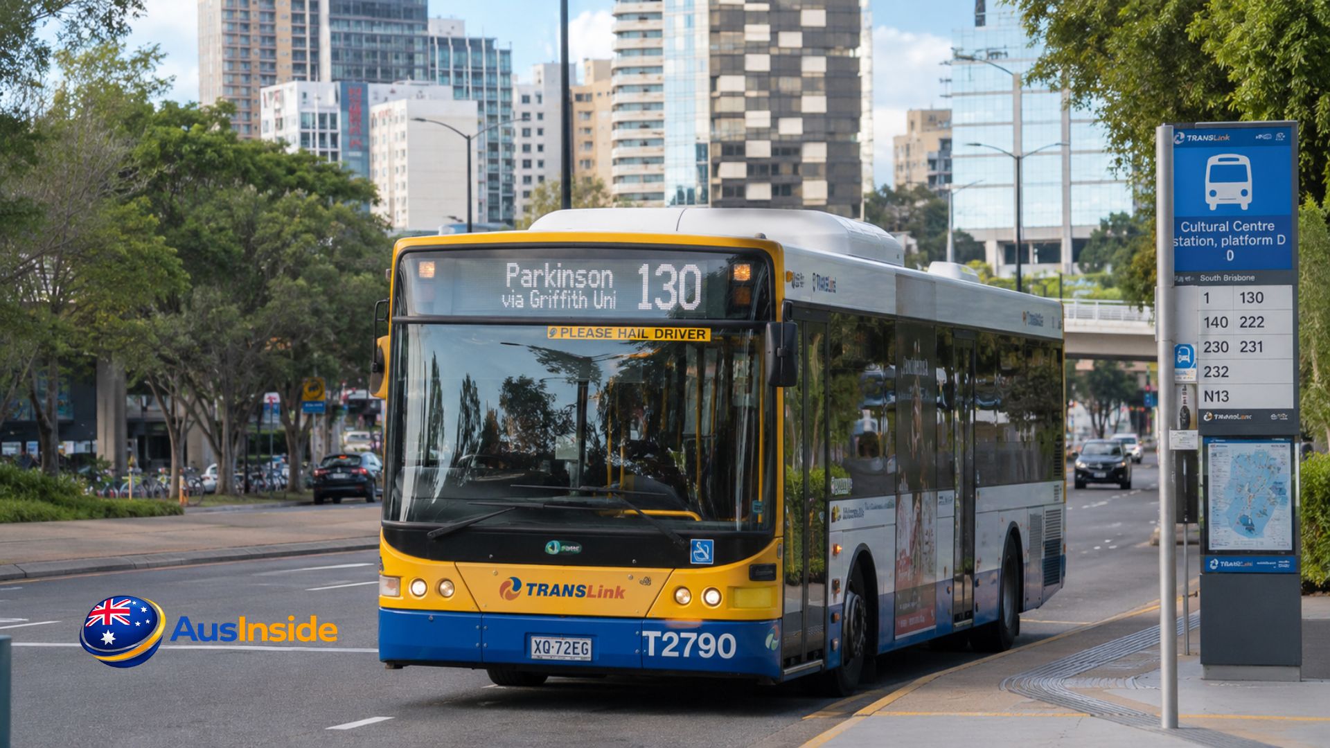
| 9 | Cultural Centre | GOMA, State Library, busiest interchange point |
| 10 | City Hall / King George Square | Main CBD interchange for M1 and M2 |
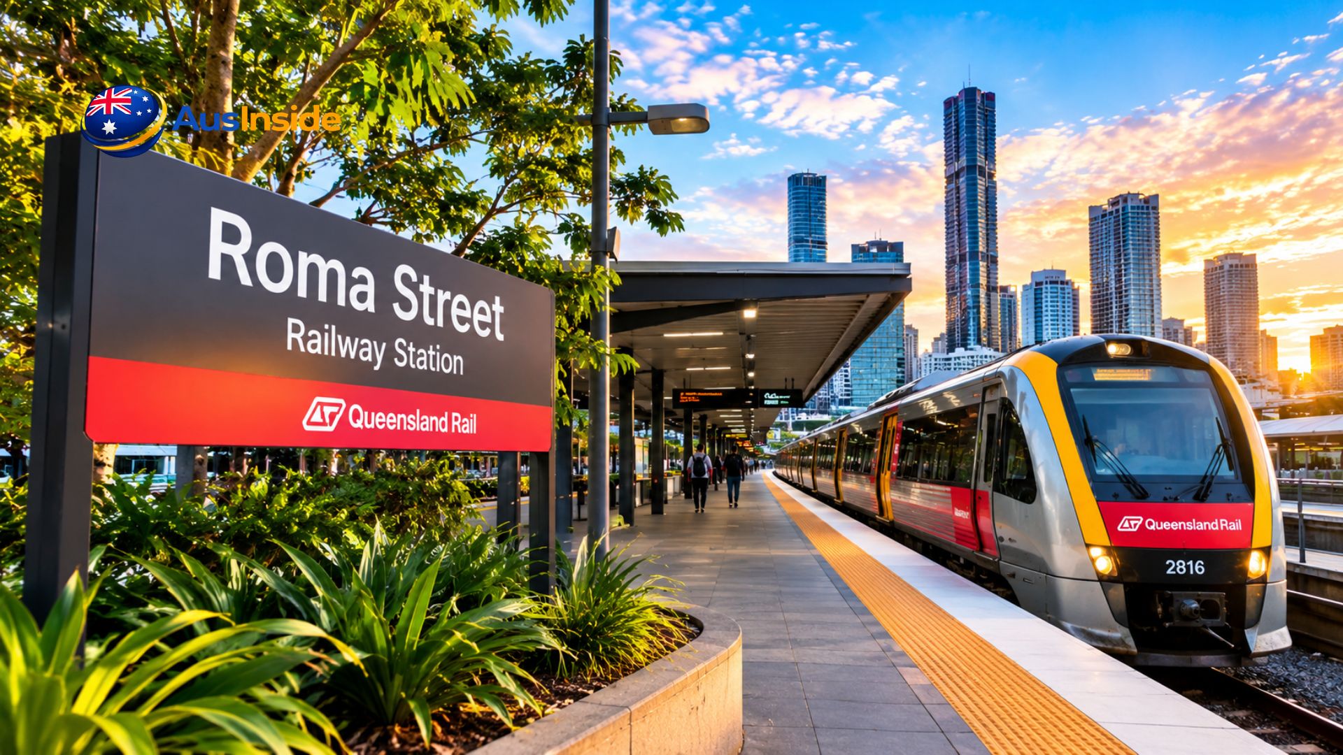
| 11 | Roma Street | Northern terminus, connects to Roma Street rail station |
The detail most competitor guides miss: M1 does not stop at Woolloongabba, despite earlier project proposals suggesting it would. If you’re heading to a Gabba event, you’ll need to get off at Buranda or Mater Hill and walk, or transfer to a local bus route that does serve Woolloongabba directly.
M1 Timetable and Frequency
| Time period | Frequency |
| Weekdays, ~6am–6pm | Every 5 minutes |
| Weekdays, outside peak | Every 10–15 minutes |
| Weekends | Every 10–15 minutes |
| Friday evening through Sunday evening | 24-hour service |
There’s no fixed timetable to memorise for peak periods — you turn up and the next service is rarely more than five minutes away. That’s the actual point of the system, and TransLink’s own journey planner reflects live departures rather than a printed schedule, which is worth bookmarking over any third-party timetable page.
In our experience, that 5-minute figure holds up reliably on a normal weekday. User-reported on-time data from transit tracking apps puts the M1’s on-time performance at roughly 85%, ranking it among the more reliable routes in the entire TransLink network. Where it slips is around Cultural Centre station during South Bank events or Gabba match days — dwell times stretch out and real gaps between services can hit 7–8 minutes even though the schedule says 5.
M1 Fares: What You’ll Actually Pay
Queensland’s 50-cent flat fare, originally a six-month cost-of-living trial launched in August 2024, was made permanent by the Crisafulli Government and has since been locked in through state legislation. It applies to every trip on M1, regardless of distance, using a go card, contactless bank card, or linked smartphone.
| Payment method | Cost |
| go card | 50 cents flat |
| Contactless debit/credit card | 50 cents flat |
| Children under 5 | Free |
| Children 5–14, weekends only | Free (orange child go card) |
| Cash | Not accepted anywhere on the network |
Two things catch people out:
- Airtrain services are excluded from the 50-cent rate. If your trip touches the airport rail line, separate Airtrain pricing applies even if you tap on with the same card.
- The go card itself is being phased out during 2026 in favour of a new Translink card and wider contactless support — check TransLink’s fares and tickets page before you buy a physical card if you’re visiting later in the year.
The M1 Vehicle: What You’re Actually Riding
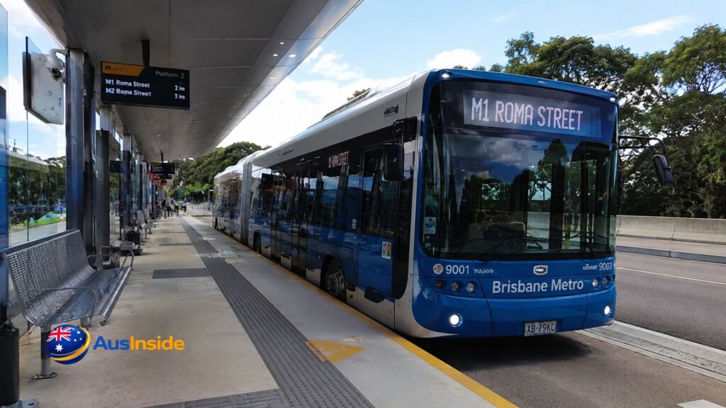
The M1’s HESS lighTram 25 TOSA vehicles are a different category of machine to a normal city bus, and it’s worth knowing the specs before you board one for the first time.
- Length and width: 24.4 metres long, 2.6 metres wide — roughly double a standard Brisbane bus
- Capacity: 150 passengers in normal service, up to 170 in event mode; 64 seats, including 10 priority seats
- Doors: Three double doors for all-door boarding, plus an automated ramp in the front compartment
- Power: Fully electric, using lithium-titanium-oxide batteries and a TOSA rapid-charging system that tops up the battery in under six minutes at each end of the route
- Onboard tech: Real-time route displays, hearing loops, audio announcements, USB-A and USB-C charging, and free WiFi
- Top speed: 90 km/h
A detail that genuinely surprises most first-time riders: the onboard passenger announcements are voiced by Melanie Zanetti, the actor who plays Chilli Heeler in Bluey. It’s a small thing, but it’s the kind of detail you won’t find on TransLink’s fact sheet.
The full fleet of 60 vehicles cost around $190 million — roughly $100 million more than an equivalent diesel fleet — with the final vehicle delivered to the Rochedale depot in April 2026. That depot itself runs on 2,300 solar panels and uses rainwater harvesting for vehicle washing, which is a genuinely unusual level of sustainability build-out for a bus depot.
How M1 Replaced Routes 111 and 160
M1 isn’t new infrastructure so much as a new service model layered onto an existing corridor. The South East Busway it runs on opened in stages between 2000 and 2001, and by 2007 it was already carrying 294 buses an hour past its busiest point near Woolloongabba — a bottleneck that was the direct catalyst for the entire Metro project.
The original 2016 plan wasn’t for buses at all. Brisbane City Council initially proposed a single-track, driverless rubber-tyred metro through a new tunnel between Woolloongabba and Herston. That plan was scrapped in 2017 in favour of the current bi-articulated bus model, cutting the projected cost by roughly a third. Routes 111 and 160 ran their final services on the night of 29 June 2025, and M1 launched the following morning alongside Brisbane’s New Bus Network — the largest bus network overhaul in over a decade.
What Most Guides Get Wrong About M1
This is the part most SEO content skips because it requires actually digging past the press releases.
- The name is contested. A 2023 Brisbane Times poll found 71% of respondents preferred an alternative name — Brisbane Electric Rapid Transit (BERT) — because “Metro” implies a train system under the International Association of Public Transport’s own definition. Council has rejected renaming it.
- Route 86 was cut to help fund the launch. The “Kurilpa Loop” free bus service was discontinued the same day M2 launched, despite a community petition to keep it running. This wasn’t heavily publicised at the time.
- The total project cost roughly doubled during planning. From an initial $944 million budget in 2017 to a final $1.55 billion figure — not counting a separate $150 million allocated to business-casing future extensions.
- The Woolloongabba station was cut entirely, not delayed. A proposed $450 million bus station at the Gabba was scrapped after a business case, with funding redirected to expansion planning instead.
- M1 isn’t the busway’s only traffic. The corridor still carries dozens of other bus routes (32 at Roma Street alone), so “Metro” isn’t a dedicated line in the way a train line is — you’re sharing infrastructure with a large chunk of Brisbane’s regular bus network.
How to Ride M1: Step-by-Step
- Load a go card or use a contactless bank card. No paper tickets, no cash, anywhere on the network.
- Find the correct platform. At shared stations like King George Square, M1 and M2 use different bays — check the overhead signage, not just the station name.
- Tap on at the platform reader before boarding, not on the vehicle itself.
- Board through any of the three doors. Fares are pre-validated at the platform, so there’s no queuing at a single door.
- Watch the onboard display for your stop, and listen for the announcement — remember, M1 doesn’t stop at Woolloongabba even if your trip planner suggests it’s nearby.
- Tap off at your destination platform before leaving the busway.
- Transfer at King George Square or Cultural Centre if you need to switch to M2 or a connecting bus route.
Best Things to Do Along the M1 Route
Because M1 runs through some of Brisbane’s most walkable precincts, it doubles as a decent way to spend a day without a car. Council’s own suggested itinerary — which we’ve walked ourselves — starts at Roma Street Parkland near the northern terminus, rides through the Adelaide Street tunnel to South Bank for the parklands and Streets Beach, stops at Greenslopes for the recently upgraded Hanlon Park, and finishes at Westfield Garden City near the Upper Mt Gravatt end of the line.
If you’re planning a longer Brisbane visit around public transport rather than a hire car, it’s worth mapping M1 stops against a proper city itinerary first — we cross-check our own route notes against the broader Brisbane travel coverage on ausinside.com before finalising a day plan, since walking distances from some platforms (South Bank especially) are longer than map apps suggest.
M1 Reliability: On-Time Performance and Known Bottlenecks
User-reported on-time data ranks M1 around 20th out of 494 tracked TransLink lines, with roughly 85% of trips arriving on schedule based on rider reports. That’s a genuinely strong figure for a bus-based system sharing infrastructure with dozens of other routes.
The known weak point is Cultural Centre station, historically the busway’s worst bottleneck — the same pinch point that made buses queue back over Victoria Bridge before Metro even existed. The Adelaide Street tunnel, a 213-metre underground connection between North Quay and King George Square, opened on 29 September 2025 specifically to relieve this pressure by routing buses under the CBD rather than through surface streets. It’s helped, but Cultural Centre still absorbs the crowd overflow from South Bank events and Gabba match days.
M1 vs M2: Quick Comparison
| Factor | M1 | M2 |
| Route | Eight Mile Plains ↔ Roma Street | UQ Lakes ↔ RBWH |
| Length | 17 km | Shorter, northern corridor |
| Stations | 11 | 12 |
| Launched | 30 June 2025 | 28 January 2025 |
| Replaced | Routes 111, 160 | Route 66 |
Future of M1: The Springwood Extension
Brisbane City Council and the Queensland Government have proposed extending M1 further south along the South East Busway to Springwood, via Rochedale. As of March 2026, this extension was included in Infrastructure Australia’s 2026 Infrastructure Priority List within the 2–4 year delivery pipeline — a meaningfully more concrete commitment than the vague “future expansion” language Council used through 2024 and 2025. No confirmed construction start date has been announced publicly yet, so treat any specific opening-year claim you see elsewhere with some skepticism until Council issues a formal timeline.
FAQs
Does M1 stop at Woolloongabba?
No. Despite early planning documents suggesting it would, the current M1 route skips Woolloongabba entirely. Get off at Buranda or Mater Hill and walk, or use a connecting local bus route.
How much does the M1 cost per trip?
A flat 50 cents with a go card or contactless card, under Queensland’s now-permanent flat fare policy. Airtrain trips are the one exception.
How often does M1 run?
Every 5 minutes on weekdays during the day, 10–15 minutes outside peak, and 24 hours a day from Friday evening through Sunday evening.
Is Brisbane Metro M1 actually a train?
No. It’s an all-electric bi-articulated bus running on dedicated busway infrastructure. It doesn’t meet the International Association of Public Transport’s technical definition of a metro, which is why the naming has been publicly disputed since 2022.
Will M1 be extended?
A Springwood extension via Rochedale is in Infrastructure Australia’s 2026 priority pipeline for delivery within 2–4 years, but no construction start date has been confirmed. Check TransLink’s official Brisbane Metro page for the current status before planning around it, and see our companion coverage on ausinside.com for wider Brisbane transport updates as the expansion business case develops.