
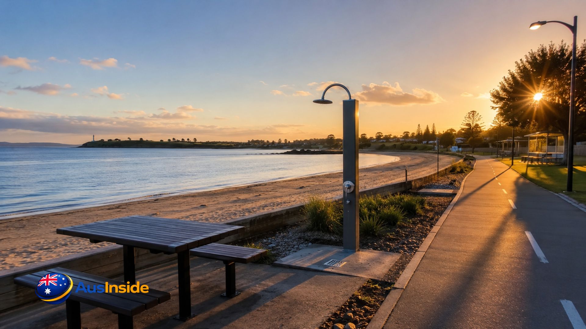
East Devonport Beach is a 400-metre, low-gradient sand beach at the mouth of the Mersey River (around -41.172, 146.371), reached off Melrose Street with free parking, showers, BBQs, and an off-leash dog zone. There’s no surf lifesaving patrol here, ever, and the water quality status changes with the season — two facts most beach directories skip entirely. We pulled council monitoring data, cross-checked recent visitor reports, and walked the site across different tide stages to put together what you actually need before driving out.
- Quick Answer: Is It Worth Visiting?
- Where Is East Devonport Beach & How to Get There
- What the Beach Actually Looks Like
- Facilities Checklist: What's Actually On Site
- Water Quality: The Part Most Guides Get Wrong
- Swimming Safety Beyond Water Quality
- Dog Exercise Area: Rules Most Visitors Miss
- Best Time to Visit
- Nearby Beaches, By Distance
- Nearby Attractions to Pair With Your Visit
- Where to Stay Near East Devonport Beach
- Fishing at the Mersey River Mouth
- Rules Visitors Often Break Without Realising
- FAQs
Quick Answer: Is It Worth Visiting?
Yes, for a calm, uncrowded local beach that works for swimming, dog walking, and sunset photography. It’s not a surf beach and it’s not manicured — expect the occasional seaweed drift line at the high-water mark, a fact visitor reviews mention repeatedly and council pages don’t. If you want patrolled swimming, go to Mersey Bluff instead. If you want quiet water and easy parking, this is the better pick.
Where Is East Devonport Beach & How to Get There
The beach sits on the eastern bank of the Mersey River mouth, directly across from Mersey Bluff, within the East Devonport suburb of Devonport, Tasmania.
Car Access via Melrose Street
Melrose Street is the primary entry point, roughly a five-minute drive from the East Devonport Spirit of Tasmania ferry terminal. That proximity is underused — most guides don’t flag it, but this beach is a genuinely practical stop if you’re killing time before or after a Bass Strait crossing.
Parking Situation
- Free car park at the Melrose Street entrance
- A second, smaller car park near the eastern end, close to the dog exercise zone
- The adjoining caravan park pulls some overflow traffic, so parking tightens over the December–January peak
- No paid parking as of our last check — unusual for a beach this close to a major ferry terminal
What the Beach Actually Looks Like
This isn’t a postcard white-sand beach. It’s a working river-mouth beach with a genuinely low gradient, so the sand shelves out gradually rather than dropping off — one reason it’s rated suitable for swimmers of most abilities. At low tide you get the full 400-metre stretch of exposed sand; at high tide that shrinks considerably, so time a walk around low tide if you want the full length.
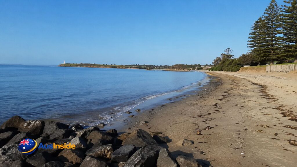
A detail almost no visitor guide mentions: geological surveys have recorded zeolitised vesicular basalt exposed along this beach, similar to the rock found at nearby Leith. If you’re into coastal geology or just curious what those dark, pitted rocks near the tideline actually are, that’s your answer.
- Low, gentle sand gradient — good for young kids and less confident swimmers
- Calmer water than open-coast beaches nearby, due to the river-mouth position
- Basalt rock exposure visible at low tide, more prominent toward the eastern section
- Clear sightlines across to the Mersey Bluff lighthouse, especially strong at sunset
Facilities Checklist: What’s Actually On Site
- Public toilets
- Showers
- Sealed walking and cycling track along the waterfront
- Electric BBQs
- Picnic shelter and tables
- Car park (two access points)
- Adjacent caravan park (paid accommodation)
- Wheelchair-accessible toilet and shower/change room
- Step-free outdoor pathways around picnic areas
- A new all-access ramp onto the sand — recently added, and genuinely useful for prams, mobility aids, and wheelchairs, though it’s rarely mentioned in older write-ups
What Older Guides Get Wrong or Leave Out
A lot of directory-style listings for this beach recycle the same council paragraph without adding anything current. Here’s what that misses:
- Toilet condition is inconsistent. Recent visitor feedback flags the toilets as needing upkeep — worth knowing before you rely on them for a full day trip.
- Seaweed accumulates at the high-tide line. It’s not constant, but it’s common enough that multiple independent visitors mention it. Don’t expect a raked, resort-style beach.
- The all-access ramp is new. Several older write-ups predate it and still describe the beach as having standard sand access only.
- “Water quality is monitored” needs a real explanation. Every generic listing repeats this phrase. Almost none explain what’s actually tested, how often, or what triggers a closure — which is the part that actually matters if you’re planning to swim.
How It Compares to Mersey Bluff Beach
| Feature | East Devonport Beach | Mersey Bluff Beach |
| Patrolled by lifesavers | No, at any time of year | Yes (summer months only) |
| Surf conditions | Flat, river-mouth calm | Moderate, wave-exposed |
| Parking | Free, two car parks | Free, larger reserve |
| Dog exercise area | Yes (Wright St to Pardoe Beach) | No |
| Accessibility | Wheelchair toilet + new access ramp | Standard access |
| Best for | Families, dog walkers, calm swimming | Surfing, active swimmers |
Water Quality: The Part Most Guides Get Wrong
This is where generic listings fall short, so here’s the actual mechanism behind that “monitored during summer” line you’ll see everywhere.
Devonport City Council runs a Beach Watch program covering four beaches — Mersey Bluff, Coles Beach, Back Beach, and East Devonport Beach — under the Public Health Act 1997 and the Recreational Water Quality Guidelines 2007.
- Testing window: December through March (the summer swimming season)
- Testing frequency: Fortnightly, not continuous
- What’s tested: Enterococci bacteria levels — the standard indicator for contamination risk
- Results: Published every two weeks via an interactive water quality map on the council’s Beach Watch page, colour-coded green (safe), blue (caution, awaiting retest), or red (unsafe)
- Rain rule: Council explicitly advises against swimming for at least 48 hours after heavy rainfall, since stormwater runoff affects bacteria levels
- Outlet warning: Avoid swimming near stormwater outlets or urban rivulets specifically — these are the highest-risk zones even when the overall beach reads “safe”
The practical takeaway: a “safe” reading from two weeks ago tells you very little after a heavy rain event. Check the live map or on-beach signage on the day, not the week before.
Swimming Safety Beyond Water Quality
There’s no Surf Life Saving Australia patrol at East Devonport Beach at any time of year. That’s consistent with the wider stretch of coast here — Pardoe Beach, which borders the dog exercise zone, carries a general hazard rating around moderate on the Beachsafe hazard database, and none of these beaches have lifeguard services.
What that means practically:
- Swim during daylight, with someone else present
- Treat any rip or current warning signage as current, not historical
- The river-mouth position generally keeps waves down, but tidal flow near the mouth can still move faster than it looks
Dog Exercise Area: Rules Most Visitors Miss
- Off-leash zone runs from Wright Street through to and including Pardoe Beach
- Access points: Wright Street, Tarleton Street, North Caroline Street, or Tea Tree Lane
- Outside this defined stretch, standard leash rules apply, and council rangers do patrol
- Bring your own bags — bin coverage exists but isn’t guaranteed at every access point
Best Time to Visit
| Season | Conditions | Best For |
| Summer (Dec–Feb) | Warmest water, busiest car parks, active water testing | Swimming, family days |
| Autumn (Mar–May) | Fewer crowds, mild water, strong afternoon light | Walking, photography |
| Winter (Jun–Aug) | Cold, often windy off Bass Strait, quiet | Dog walking, solitude |
| Spring (Sep–Nov) | Variable weather, improving crowds | Fishing, early-season visits |
For reference, Devonport’s mean maximum temperature sits around 17°C annually with roughly 773mm of rainfall a year, so even “summer” here runs cooler than mainland Australian beach towns — pack a layer regardless of the season.
Nearby Beaches, By Distance
If East Devonport Beach isn’t quite what you’re after, here’s what’s within a short drive, closest first:
| Beach | Approx. Distance |
| Bluff Beach | 0.9 mi |
| Back Beach | 1.1 mi |
| Pardoe Beach | 1.6 mi |
| Coles Beach | 1.7 mi |
| Moorland Beach | 3.7 mi |
| Lillico Beach | 4.2 mi |
| Northdown Beach | 5.9 mi |
Lillico Beach in particular is worth the extra drive if you’re after little penguin viewing at dusk — a detail casual visitors specifically call out and one that East Devonport Beach itself doesn’t offer.
Nearby Attractions to Pair With Your Visit
- Tiagarra Aboriginal Cultural Centre — short drive, covers local Aboriginal heritage and rock art
- Don River Railway Reserve — walking trails plus a heritage railway, solid half-day add-on
- Mersey Bluff and lighthouse — visible across the river mouth, worth the short trip for the contrast in coastline and the patrolled swimming option
- Bass Strait Maritime Museum — relevant if the Spirit of Tasmania and the port’s shipping history interest you
If you’re mapping out a wider Tasmania coastal trip, a beach-by-beach comparison resource like ausinside.com’s Tasmania beach guide is worth bookmarking before you lock in a route — it saves cross-referencing five different council pages the way we just did here.
Where to Stay Near East Devonport Beach
- The Cove Tasmania — resort-style rooms, the closest higher-end option
- Gateway Hotel by Nightcap Plus / Gateway Hotel — central, practical, convenient for ferry travellers
- The adjoining caravan park — most direct option if you want beach access without a car trip each morning
Fishing at the Mersey River Mouth
The river-mouth position draws a steady stream of local anglers, especially around tide changes. There’s no dedicated fishing jetty at this specific beach — for structured fishing infrastructure, the East Esplanade Boat Ramp services the wider area. Bank fishing directly off the beach is common; check current Tasmanian recreational fishing rules before keeping anything.
Rules Visitors Often Break Without Realising
- Removing rocks, pebbles, or driftwood — illegal without a Tasmania Parks & Wildlife Service permit. Beaches up to the high tide line are managed by DPIPWE and Parks & Wildlife, not the council.
- Letting dogs off-leash outside Wright Street–Pardoe Beach — actively enforced by rangers
- Swimming right after heavy rain — council’s own 48-hour guideline exists for a reason, and it isn’t advisory in the sense of being optional if you want to avoid getting sick
- Assuming a “safe” reading is current — fortnightly testing means the status can lag real conditions
FAQs
Is East Devonport Beach patrolled by lifesavers?
No, at any time of year. Mersey Bluff Beach is the only patrolled option nearby, and only during summer months.
Can I bring my dog off-leash?
Yes, within the designated zone running from Wright Street to Pardoe Beach. Outside that stretch, standard leash rules apply.
How do I check current water quality before swimming?
Use the council’s live Beach Watch map or check on-beach signage on the day — testing is fortnightly, so don’t rely on a status you read a week ago.
Is it good for swimming with kids?
Generally yes. The low gradient and calmer river-mouth water make it easier going than open-coast beaches nearby, though there’s still no lifeguard supervision.
Is parking free?
Yes, at both car park entrances off Melrose Street, though space tightens on peak summer weekends.
How far is it from the Spirit of Tasmania ferry terminal?
About five minutes by car, making it a practical stop before or after a sailing.
Why does the beach sometimes look covered in seaweed?
Seaweed and kelp drift onto the high-tide line periodically — a natural, common occurrence at this beach that several recent visitors have flagged. It’s not a sign of poor water quality; check the actual testing data if that’s your concern.